
Tumakuru, commonly known as Tumkur, is a small industrial city about 70 km from Bangalore, the capital city of Karnataka. It is also known as the ‘Coconut City’ due to numerous palm trees found in this town. Not only does it consist of some major industrial companies such as WIPRO, TVS Electronics and System Consultant Confirmation of India; but is also involved in production of rough cotton, blankets, watches and ropes. It is a part of the Tumkur district with its ten talukas namely, Tumkur, Sira, Turuvakere, Kunigal, Tiptur, Madhugiri, Koratgere, Chikkanayakanahalli, Gubbi and Pavagada, with its district headquarters in Tumkur City. Each district consists of one or two cities, a small number of towns and numerous villages. The Tumkur District, an area of 10,598 square kilometers, is bounded by Mandhya district from the South side, Chikkamangalore from the north east side, Chitradurga and Hassan district from the west side and Ananthapura (district belonging to Andhra Pradesh) from the southeast side.
On being rewarded as being India's Most Promising Drone Consultants, IG Drones is now a leading drone service provider of India. IG Drones came into existence in 2018, with an objective of providing enterprise drone solutions across India and revolutionizing traditional industrial procedures with high quality efficient drones. IG Drones is one of Salem’s top drone service providers. In various other South Indian states as well, IG Drones serves by delivering drone survey solutions, drone mapping, and inspection services. IG Drones have been awarded as “Airwards's Best Drone Organisation- Startup”. It is because of our consistency in Pre and Post Disaster Assessments and constant efforts in Search and Rescue Operations that we as a team have successfully reached up to this stage. In line with government missions, it is responsible for the training and enhancing of the abilities of India's youth to prepare them for the oncoming Industrial 4.0 Revolution. The IG Drones Drone Center of Excellence (CoE) is a program that was established with an aim of educating more than 10 million students about the new drone technologies.


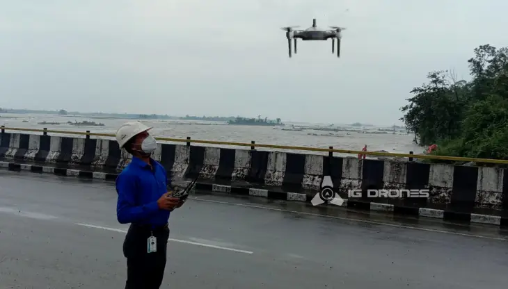
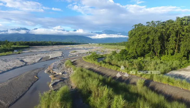
IG drones provides enumerable services such as GIS Survey, Topographic Survey, Drone Inspection, Drone Mapping, Power line Monitoring, Smart City Survey, Road Inspection & Survey, Mines Survey, Flood Assessment, Asset Monitoring, Solar Thermal Inspection, Security and Surveillance, Crop Health Monitoring, Volumetric Measurement, and Drone 3D Mapping & Modelling. Since 2018, IG Drones has been generating high-quality drone surveys and mapping services in Tumakuru (Karnataka) and other Southern regions in Visakhapatnam (Andhra Pradesh) Mysore(Karnataka) RAICHUR-KURNOOL (Andhra Pradesh) NAIDUPETA, (Andhra Pradesh) Roing (Arunachal Pradesh) Bangalore(Karnataka) Mysore (Karnataka) (Ooty) Tamil Nadu (Auroville) Tamil Nadu
Get in touch with IG DRONES to experience the India's best Drone Service Company first-hand
Contact Us!We have clients across Tumakuru Karnataka & other Southern Regions on like – G R Infraprojects Limited , Andhra Pradesh Forest Department , Geocon Surveys , Kudgi Narendra Transmission Line Sekura Roads, KEC International , ITC Limited, CK Rajan Engineering Contractor , CPWD , Andhra Pradesh Forest Department


At IG DRONES, we are always working on something new! We are proud of our latest work.
Some of our notable drone services across the industries include
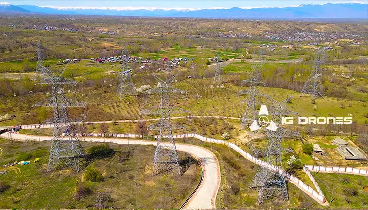
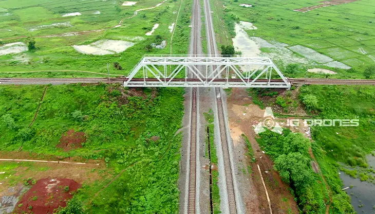
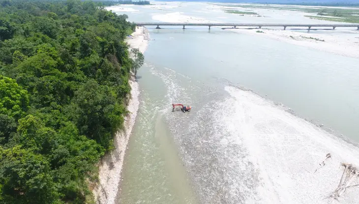
IG DRONES is a well – known drone firm that provides a bespoke, flexible and an end-to-end solution by using cutting-edge drone technology. We cover a great mass of fields such as aerial surveying, mapping, and inspection services in order to help the government and corporate sectors of the country to conserve assets up to their full potential. Drone-based power line monitoring, industrial inspection, bridge inspection, solar plant inspection, pipeline inspection, railway services (survey, mapping, and inspection), smart city survey, road survey, mine survey, agricultural survey, forest and wildlife survey, disaster assessment, wind turbine blades inspection, port survey, buildings & skyscrapers inspection, and monuments inspection are just a few among the variety of services that we provide.
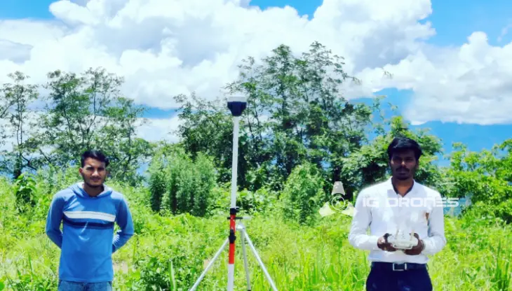
IG Drones aims at providing airborne drone surveying, mapping, and inspection services to clients across the world. IG Drones has been successful in providing a wide variety of services in land surveying, aerial surveys for land management and development, land slope monitoring, stockpile volumetric measurements, smart city design, green field project mapping, and other areas of expertise. Since IG Drones has established control over various fields, it often generates centimeter-level topographic maps. Drone Data Processing is the most recent geospatial technology innovation, and drones are used in numerous businesses. Special gratitude to our high-end surveying drones and a team of skilled licenced pilots since it is because of them that our clients get their deliveries sooner than expected. We continue to use Artificial Intelligence and Machine Learning to climb up to 99 percent accuracy in volumetric measurements, crop yield estimates, damage detection, and other areas and hence, people are forced to make decisions rapidly.


Talk to our team if you have any questions about drone surveying for your industry.
Contact Us for Drone Services in Karnataka Contact UsIG Drones provide specialist drone services at height and difficult to access areas across India. Technical end-to-end solution to help you ease your operation. Capture the smallest of details with ease. Raise your operational standards & Imagine more with us. Imagine Inspire Innovate.
