
Saharanpur is a city and a municipal corporation in Uttar Pradesh, India. It is also the administrative headquarters of Saharanpur district. Saharanpur is declared as one amongst the 100 Smart Cities by MOUD as a part of Smart Cities Mission of the Government of India. Two major National Highways pass through Saharanpur — NH 709B and NH 344. The NH 709B originates in Saharanpur and connects it to Delhi via Shamli and Baghpat, while the NH 344 connects Saharanpur with Ambala, Yamunanagar and Roorkee. Uttar Pradesh State Highway 57, commonly known as Delhi-Yamunotri highway, also passes through the city. The Delhi–Saharanpur–Dehradun Expressway has also been proposed, which will be ready by March 2024. Saharanpur Junction is the primary railway station serving the city. The station is under the administrative control of Ambala railway division of the Northern Railways and is located at the junction of Moradabad–Ambala line, Delhi–Meerut–Saharanpur line and the Delhi–Shamli–Saharanpur line.
Awarded as the India's Most Promising Drone Consultants, IG Drones is now the leading drone service providers in India. IG Drones was founded in 2018 with the goal of delivering enterprise drone solutions across India and revolutionising old industrial practises through the use of highly efficient drones. It is a leading provider of drone services in Saharanpur. IG Drones uses drones to provide drone surveying, mapping, and inspection services in Saharanpur and the surrounding areas of the North Indian states of Jammu, Haryana, Uttarakhand, Rajasthan, Uttar Pradesh, Himanchal Pradesh, Delhi, and UT Chandigarh.


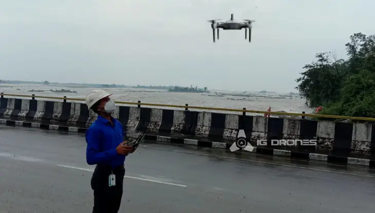
IG Drones is India’s leading Drone Service provider company providing highly accurate & detailed GIS Survey, Topographic survey, Drone Inspection, Drone Mapping, Powerline Monitoring, Smart City Survey, Road Inspection & Survey, Mines Survey, Flood Assessment, Asset Monitoring, Solar Thermal Inspection, Security and Surveillance, Crop Health Monitoring, Volumetric Measurement, Drone 3D Mapping & Modelling, Aerial Photography & Videography and many more using advanced drone technology and providing meaningful data for businesses using the latest drone technology. Since 2018, IG Drones has been delivering high-quality drone survey and mapping services in Lucknow (Uttar Pradesh) and other regions in the states of Lucknow (Uttar Pradesh), Chandigarh (Haryana), Shimla (Himachal Pradesh), Jaipur (Rajasthan), Chandigarh (Punjab), Srinagar (Jammu).
Get in touch with IG DRONES to experience the India's best Drone Service Company first-hand
Contact Us!We have clients across Uttar pradesh & other Northern states like – Department of Atomic Energy (DAE), Indian Railways, Northern Railways, National Disaster Management Authority(NDMA), National Highway Authority of India (NHAI), PowerGrid, Delhi Integrated Multi-Modal Transit System (DIMTS) Ltd., NRRI, Delhi Development Authority(DDA), Delhi Transco Limited (DTL), Adani, The World Bank, Reliance Power, Adani Transmission, Sekura, Indigrid, Transrail, Aditya Birla Hindalco, Aditya Birla Renewables, Navayuga Group, Indian Oil Corporation, HCL Foundation, Jakson Group, IL&FS, Humanitarian Aid International(HAI) etc.


.png)
.png)
.png)


At IG DRONES, we are always working on something new! We are proud of our latest work.
Some of our notable drone services across the industries include
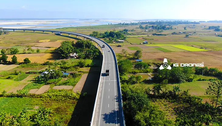
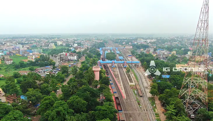
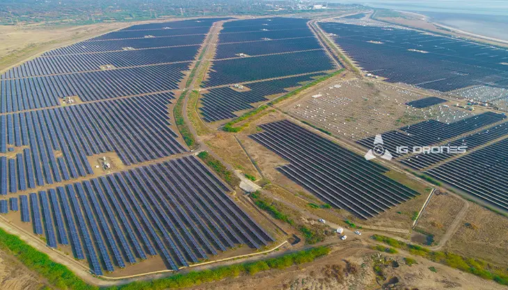
IG DRONES employs cutting-edge drone technology to develop an adaptive and scalable end-to-end solution. Our aerial survey, mapping, and inspection services have helped the country's government and corporate sectors preserve assets to their maximum potential. Drone-based Powerline Monitoring, Industrial Inspection, Bridge Inspection, Solar Plant Inspection, Pipeline Inspection, Railway Services (Survey, Mapping & Inspection), Smart City Survey, Road Inspection, Mine Survey, Agricultural Survey, Forest & Wildlife Survey, Disaster Assessment, Wind Turbine Blades Inspection, Port Survey, Buildings & Skyscrapers Inspection, and Monuments Inspection are just a few of the services available.
IG Drones' mission is to provide aerial drone surveying, mapping, and inspection services to clients worldwide. Land surveying, aerial surveys for land management and development, land slope monitoring, stockpile volumetric measurements, smart city design, greenfield project mapping, and other services are among our specialties. IG Drones prioritises accuracy and, as a result, regularly provides highly accurate topographic maps with centimetre-level precision. Drone Data Processing is the most recent geospatial technology trend, with drone applications spanning many industries. Because of high-end surveying drones and a team of skilled licenced pilots, our clients receive their deliverables faster. Using Artificial Intelligence and Machine Learning, we continue to achieve up to 99 percent accuracy in Volumetric Measurements, Crop Yield Estimates, Damage Detection, and other areas. As a result, people are pushed to make decisions more quickly.


Talk to our team if you have any questions about drone surveying for your industry.
Contact Us for Drone Services in Uttar Pradesh Contact UsIG Drones provide specialist drone services at height and difficult to access areas across India. Technical end-to-end solution to help you ease your operation. Capture the smallest of details with ease. Raise your operational standards & Imagine more with us. Imagine Inspire Innovate.
