
Allahabad, officially known as Prayagraj, also known as Ilahabad, is a metropolis in the Indian state of Uttar Pradesh. Allahabad lies close to Triveni Sangam, the "three-river confluence" of the Ganges, Yamuna and Saraswati rivers. Allahabad has hosted cultural and sporting events, including the Prayag Kumbh Mela. The development of infrastructure in the city is overseen by the Allahabad Development Authority (ADA), which comes under the Department of Housing and Urban Planning of Uttar Pradesh government. Allahabad Junction is one of the main railway junctions in northern India and headquarters of the North Central Railway Zone. IBM selected Allahabad among 16 other global cities for its smart cities programme to help it address challenges like waste management, disaster management, water management and citizen services. A memorandum of understanding was signed on 25 January 2015 between the United States Trade and Development Agency (USTDA) and the Government of Uttar Pradesh for developing Allahabad as a smart city.
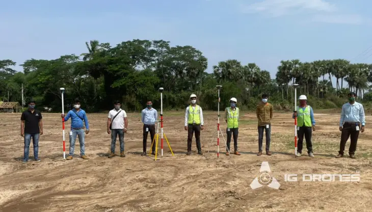
Awarded as the India's Most Promising Drone Consultants, IG Drones is now the leading drone service providers in India. IG Drones was founded in 2018 with the goal of delivering enterprise drone solutions across India and revolutionising old industrial practises through the use of highly efficient drones. It is a leading provider of drone services in Prayagraj. IG Drones uses drones to provide drone surveying, mapping, and inspection services in Prayagraj and the surrounding areas of the North Indian states of Jammu, Haryana, Uttarakhand, Rajasthan, Uttar Pradesh, Himachal Pradesh, Delhi, and UT Chandigarh.


IG Drones is India’s leading Drone Service provider company providing highly accurate & detailed GIS Survey, Topographic survey, Drone Inspection, Drone Mapping, Powerline Monitoring, Smart City Survey, Road Inspection & Survey, Mines Survey, Flood Assessment, Asset Monitoring, Solar Thermal Inspection, Security and Surveillance, Crop Health Monitoring, Volumetric Measurement, Drone 3D Mapping & Modelling, Aerial Photography & Videography and many more using advanced drone technology and providing meaningful data for businesses using the latest drone technology. Since 2018, IG Drones has been delivering high-quality drone survey and mapping services in Prayagraj (Uttar Pradesh) and other regions in the states of Lucknow (Uttar Pradesh), Chandigarh (Haryana), Shimla (Himachal Pradesh), Jaipur (Rajasthan), Chandigarh (Punjab), Srinagar (Jammu).
Get in touch with IG DRONES to experience the India's best Drone Service Company first-hand
Contact Us!We have clients across Uttar Pradesh & other Northern states like – Department of Atomic Energy (DAE), Indian Railways, Northern Railways, National Disaster Management Authority(NDMA), National Highway Authority of India (NHAI), PowerGrid, Delhi Integrated Multi-Modal Transit System (DIMTS) Ltd., NRRI, Delhi Development Authority(DDA), Delhi Transco Limited (DTL), Adani, The World Bank, Reliance Power, Adani Transmission, Sekura, Indigrid, Transrail, Aditya Birla Hindalco, Aditya Birla Renewables, Navayuga Group, Indian Oil Corporation, HCL Foundation, Jakson Group, IL&FS, Humanitarian Aid International(HAI) etc.


.png)
.png)


.png)


At IG DRONES, we are always working on something new! We are proud of our latest work.
Some of our notable drone services across the industries include
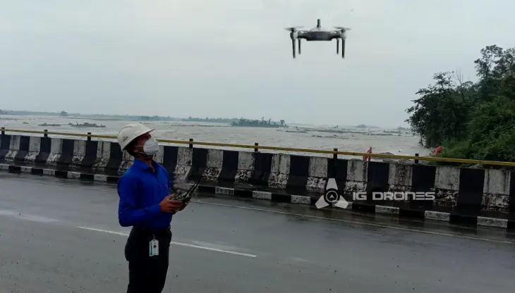
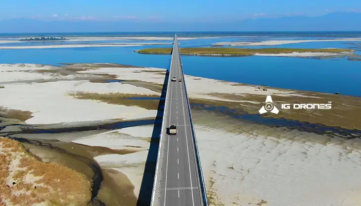
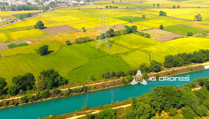
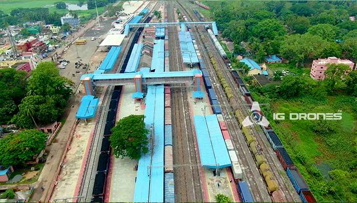
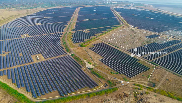
IG DRONES develops an adaptive and scalable end-to-end solution using cutting-edge drone technology. Our aerial survey, mapping, and inspection services have assisted the government and corporate sectors of the country in preserving assets to their full potential. Drone-based Powerline Monitoring, Industrial Inspection, Bridge Inspection, Solar Plant Inspection, Pipeline Inspection, Railway Services (Survey, Mapping & Inspection), Smart City Survey, Road Inspection, Mine Survey, Agricultural Survey, Forest & Wildlife Survey, Disaster Assessment, Wind Turbine Blades Inspection, Port Survey, Buildings & Skyscrapers Inspection, and Monuments Inspection are just a few of the services available.
The mission of IG Drones is to provide aerial drone surveying, mapping, and inspection services to clients all over the world. Among our specialties are land surveying, aerial surveys for land management and development, land slope monitoring, stockpile volumetric measurements, smart city design, greenfield project mapping, and other services. IG Drones prioritises accuracy and, as a result, provides highly accurate topographic maps with centimetre-level precision on a regular basis. Drone Data Processing is the most recent geospatial technology trend, with drone applications spanning a wide range of industries. Our clients receive their deliverables faster because we use high-end surveying drones and a team of skilled licenced pilots. We continue to achieve up to 99 percent accuracy in Volumetric Measurements, Crop Yield Estimates, Damage Detection, and other areas by utilising Artificial Intelligence and Machine Learning. As a result, people are pressed to make decisions faster.


Talk to our team if you have any questions about drone surveying for your industry.
Contact Us for Drone Services in Uttar Pradesh Contact UsIG Drones provide specialist drone services at height and difficult to access areas across India. Technical end-to-end solution to help you ease your operation. Capture the smallest of details with ease. Raise your operational standards & Imagine more with us. Imagine Inspire Innovate.
