
Puducherry, also called Pondicherry, city, capital of Puducherry union territory, southeastern India. The city constitutes an enclave surrounded by Tamil Nadu state, on the Coromandel Coast of the Bay of Bengal, 105 miles (170 km) south of Chennai (Madras). All four areas of the territory are seaside tourist resorts. The city of Puducherry is divided into two parts by a canal, and all the main streets, running parallel to one another, lead to the open roadstead offshore. The port of Puducherry does not have a harbor, and ships are forced to lie about 1 to 2 miles (1.5 to 3 km) offshore, but its roadstead was once considered the best on the Coromandel Coast. There are a promenade, a landing place for cargo, and a pier. In and around the city are artesian wells that supply a large quantity of water for irrigation, the chief local crops being rice, sugarcane, cotton, and peanuts (groundnuts). The main industries are food processing and the manufacture of electrical appliances, textiles, paper, and lumber. The Puducherry area has about 300 villages and hamlets.
On being rewarded as being India's Most Promising Drone Consultants, IG Drones is now a leading drone service provider of India. IG Drones was established in 2018 and it aimed at providing enterprise drone solutions across India and revolutionizing traditional industrial procedures with high quality efficient drones. IG Drones is one of Pondicherry’s top drone service providers. In various other South Indian states as well, IG Drones deliver drone survey solutions, drone mapping, and inspection services. IG Drones have been awarded as “Airwards's Best Drone Organisation-Startup”. It is because of our consistency in Pre and Post Disaster Assessments and constant efforts in Search and Rescue Operations that we as a team have successfully reached up to this stage. In line with government missions, it is responsible for the training and enhancing of the abilities of India's youth to prepare them for the oncoming Industrial 4.0 Revolution. The IG Drones Drone Center of Excellence (CoE) is a program that was established with an aim of educating more than 10 million students about the newest drone technologies.


IG drones provides enumerable services such as GIS Survey, Topographic Survey, Drone Inspection, Drone Mapping, Power line Monitoring, Smart City Survey, Road Inspection & Survey, Mines Survey, Flood Assessment, Asset Monitoring, Solar Thermal Inspection, Security and Surveillance, Crop Health Monitoring, Volumetric Measurement, and Drone 3D Mapping & Modelling. Since 2018, IG Drones has been generating high-quality drone surveys and mapping services in Pondicherry (Pondicherry) and other Southern regions in Visakhapatnam (Pondicherry) Mysore(Karnataka) RAICHUR-KURNOOL (Pondicherry) NAIDUPETA, (Pondicherry) Roing (Arunachal Pradesh) Bangalore(Karnataka) Mysore (Karnataka) (Ooty) Pondicherry (Auroville) Pondicherry
Get in touch with IG DRONES to experience the India's best Drone Service Company first-hand
Contact Us!We have clients across Pondicherry Pondicherry & other Southern Regions on like – G R Infraprojects Limited , Pondicherry Forest Department , Geocon Surveys , Kudgi Narendra Transmission Line Sekura Roads, KEC International , ITC Limited, CK Rajan Engineering Contractor , CPWD , Pondicherry Forest Department


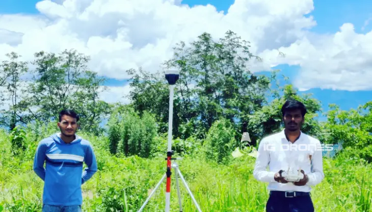
At IG DRONES, we are always working on something new! We are proud of our latest work.
Some of our notable drone services across the industries include
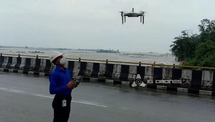
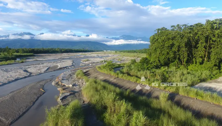
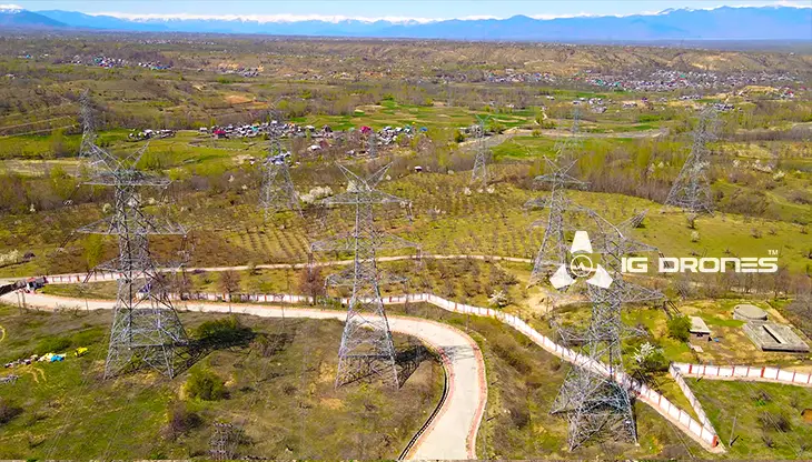
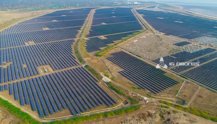
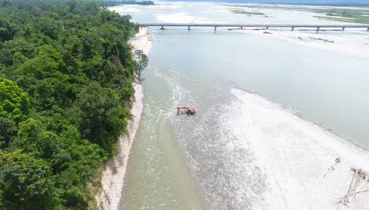
IG DRONESis a famous drone company that provides a bespoke, flexible and an end-to-end solution, using cutting-edge drone technology. We cover a great mass of fields such as aerial surveying, mapping, and inspection services in order to help the government and corporate sectors of the country to prevent assets up to their full potential. Drone-based power line monitoring, industrial inspection, bridge inspection, solar plant inspection, pipeline inspection, railway services (survey, mapping, and inspection), smart city survey, road survey, mine survey, agricultural survey, forest and wildlife survey, disaster assessment, wind turbine blades inspection, port survey, buildings & skyscrapers inspection, and monuments inspection are a few services that we provide.
IG Drones provides airborne drone surveying, mapping, and inspection services to clients around the globe. IG Drones has provided a wide variety of services in land surveying, aerial surveys for land management and development, land slope monitoring, stockpile volumetric measurements, smart city design, green field project mapping, and other areas of expertise. Since IG Drones have gained control over all fields and established a great significance on precision, it often produces centimeter-level topographic maps. Drone Data Processing is the most recent geospatial technology innovation, and drones are used in many businesses. Special gratitude to our high-end surveying drones and a team of skilled licenced pilots since it is due to them that they put in regular consistent efforts and ensure that our clients get their deliveries sooner than expected. We continue to use Artificial Intelligence and Machine Learning to climb up to 99 percent accuracy in volumetric measurements, crop yield estimates, damage detection, and other areas and hence, people are forced to make decisions rapidly.


Talk to our team if you have any questions about drone surveying for your industry.
Contact Us for Drone Services in Pondicherry Contact UsIG Drones provide specialist drone services at height and difficult to access areas across India. Technical end-to-end solution to help you ease your operation. Capture the smallest of details with ease. Raise your operational standards & Imagine more with us. Imagine Inspire Innovate.
