
Madurai is one of the oldest cities of India and was ruled by Pandya kings over most of its history. The city is famous for is rich heritage and promoting Tamil language through "Sangams". The city has been in existence since about 4th century BC and is mentioned in ancient texts of Greeks, Romans and Arabs. The Meenakshi Amman temple situated in the heart of the city is famous, and there are a number of temples in and around the city. The "Maha Kumbabhishekam" of the temple was performed in April 2009 after the renovation (re-painting) work on the gopurams (towers) of the temple. It is usually performed once every 14 years or more. There are numerous remarkable sculptures on the gopurams and inside the premises of the temple. Look out for the "yaali", a mythical creature similar to a dragon on the pillars in the 'pragaram' of the temple. Also, keep looking at the ceiling to catch a glimpse of the beautiful ancient paintings that adorn them. Madurai is also an important transit point for travellers bound south and also a local commercial hub.
IG Drones has been awarded as India's Most Promising Drone Consultants and is currently a leading drone service provider of India. IG Drones was initially founded in 2018 and it provides enterprise drone solutions across India and revolutionizes traditional industrial procedures with efficient drones. IG Drones is one of Madurai’s top drone service providers. IG Drones have been awarded as “Airwards's Best Drone Organisation-Startup”. It is because of our consistency in Pre and Post Disaster Assessments and constant efforts in Search and Rescue Operations that we as a team have successfully reached up to this stage. In various other South Indian states as well, IG Drones are of great service in order to deliver drone survey solutions, drone mapping, and inspection services. In line with government missions, it is also responsible of training and enhancing the abilities of India's youth, preparing them for the oncoming Industrial 4.0 Revolution. The IG Drones Drone Center of Excellence (CoE) is a program that was established with a sole objective of educating over 10 million students about the latest drone technologies.


IG drones provides enumerable services such as GIS Survey, Topographic Survey, Drone Inspection, Drone Mapping, Power line Monitoring, Smart City Survey, Road Inspection & Survey, Mines Survey, Flood Assessment, Asset Monitoring, Solar Thermal Inspection, Security and Surveillance, Crop Health Monitoring, Volumetric Measurement, and Drone 3D Mapping & Modelling. Since 2018, IG Drones has been generating high-quality drone surveys and mapping services in Madurai (Tamil Nadu) and other Southern regions in Visakhapatnam (Andhra Pradesh) Mysore(Karnataka) RAICHUR-KURNOOL (Andhra Pradesh) NAIDUPETA, (Andhra Pradesh) Roing (Arunachal Pradesh) Bangalore(Karnataka) Mysore (Karnataka) (Ooty) Tamil Nadu (Auroville) Tamil Nadu
Get in touch with IG DRONES to experience the India's best Drone Service Company first-hand
Contact Us!We have clients across Madurai Tamil Nadu & other Southern Regions on like – G R Infraprojects Limited , Andhra Pradesh Forest Department , Geocon Surveys , Kudgi Narendra Transmission Line Sekura Roads, KEC International , ITC Limited, CK Rajan Engineering Contractor , CPWD , Andhra Pradesh Forest Department


At IG DRONES, we are always working on something new! We are proud of our latest work.
Some of our notable drone services across the industries include
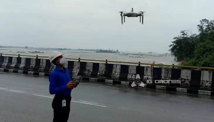
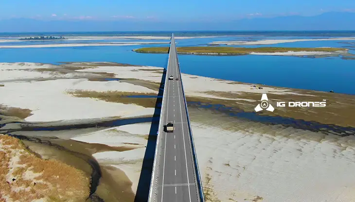
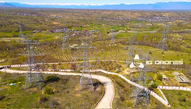
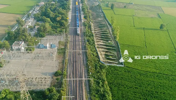
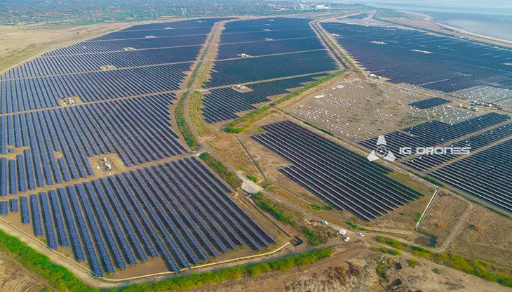
IG DRONESis a well-known drone company that provides a bespoke, flexible and an end-to-end solution, using cutting-edge drone technology. We cover a great mass of fields such as aerial surveying, mapping, and inspection services in order to help the government and corporate sectors of the country to conserve assets up to their full potential. Drone-based power line monitoring, industrial inspection, bridge inspection, solar plant inspection, pipeline inspection, railway services (survey, mapping, and inspection), smart city survey, road survey, mine survey, agricultural survey, forest and wildlife survey, disaster assessment, wind turbine blades inspection, port survey, buildings & skyscrapers inspection, and monuments inspection are just a few among the services that we provide.
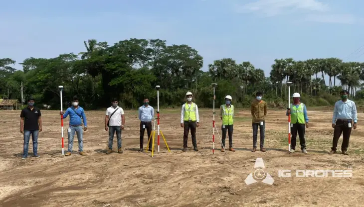
IG Drones aims to provide airborne drone surveying, mapping, and inspection services to clients around the globe. IG Drones has provided numerous services in land surveying, aerial surveys for land management and development, land slope monitoring, stockpile volumetric measurements, smart city design, green field project mapping, and other areas of expertise. Since IG Drones has conquered all fields and is well established, it often produces centimeter- level topographic maps. Drone Data Processing is the most recent geospatial technology innovation, and drones are used in numerous businesses. Special gratitude to our high-end surveying drones and a team of skilled licensed pilots for ensuring that our clients get their deliveries sooner than expected. We continue to use Artificial Intelligence and Machine Learning to climb up to 99 percent accuracy in volumetric measurements, crop yield estimates, damage detection, and other areas and hence, people are compelled to make decisions in a quick easy way.


Talk to our team if you have any questions about drone surveying for your industry.
Contact Us for Drone Services in Tamil Nadu Contact UsIG Drones provide specialist drone services at height and difficult to access areas across India. Technical end-to-end solution to help you ease your operation. Capture the smallest of details with ease. Raise your operational standards & Imagine more with us. Imagine Inspire Innovate.
