
Leh is the joint capital and largest town of the union territory of Ladakh in India. Leh, located in the Leh district, was also the historical capital of the Kingdom of Ladakh, the seat of which was in the Leh Palace, the former residence of the royal family of Ladakh, built in the same style and about the same time as the Potala Palace in Tibet. Leh is at an altitude of 3,524 m, and is connected via National Highway 1 to Srinagar in the southwest and to Manali in the south via the Leh-Manali Highway. The water for agriculture of Ladakh comes from the Indus, which runs low in March and April when barley-fields have the greatest need for irrigation. Leh is connected to the rest of India by two high-altitude roads. The National Highway 1D from Srinagar via Kargil is generally open longer. The Leh-Manali Highway can be troublesome due to very high passes and plateaus, and the lower but landslide-prone Rohtang Pass near Manali. The third road axis is under construction. There is no railway service currently in Ladakh, however 2 railway routes are proposed- the Bilaspur–Leh line and Srinagar–Kargil–Leh line.
Awarded as the India's Most Promising Drone Consultants, IG DRONES is now the leading drone service providers in India. IG Drones was created in 2018 with the purpose of delivering enterprise drone solutions across India and using highly efficient drones to revolutionise old industrial practises. It is a leading drone service provider in Leh. IG Drones employs drones to give drone survey solutions, drone mapping, and inspection services in Leh and the neighbouring areas in the North Indian states of Jammu, Haryana, Jammu and Kashmir, Rajasthan, Ladakh, Himanchal Pradesh, Uttar Pradesh, and UT Chandigarh.


IG Drones is India’s leading Drone Service provider company providing highly accurate & detailed GIS Survey, Topographic survey, Drone Inspection, Drone Mapping, Powerline Monitoring, Smart City Survey, Road Inspection & Survey, Mines Survey, Flood Assessment, Asset Monitoring, Solar Thermal Inspection, Security and Surveillance, Crop Health Monitoring, Volumetric Measurement, Drone 3D Mapping & Modelling, Aerial Photography & Videography and many more using advanced drone technology and providing meaningful data for businesses using the latest drone technology. Since 2018, IG Drones has been delivering high-quality drone survey and mapping services in Leh (Ladakh) and other regions in the states of Lucknow (Uttar Pradesh), Chandigarh (Haryana), Shimla (Himachal Pradesh), Jaipur (Rajasthan), Chandigarh (Punjab), Dehradun (Uttarakhand).
Get in touch with IG DRONES to experience the India's best Drone Service Company first-hand
Contact Us!We have clients across Ladakh & other Northern states like – Department of Atomic Energy (DAE), Indian Railways, Northern Railways, National Disaster Management Authority(NDMA), National Highway Authority of India (NHAI), PowerGrid, Delhi Integrated Multi-Modal Transit System (DIMTS) Ltd., NRRI, Delhi Development Authority(DDA), Delhi Transco Limited (DTL), Adani, The World Bank, Reliance Power, Adani Transmission, Sekura, Indigrid, Transrail, Aditya Birla Hindalco, Aditya Birla Renewables, Navayuga Group, Indian Oil Corporation, HCL Foundation, Jakson Group, IL&FS, Humanitarian Aid International(HAI) etc.


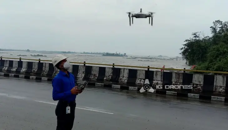
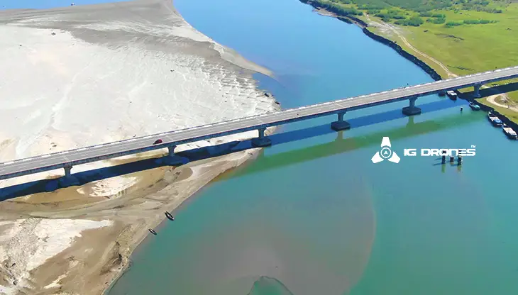
.png)
.png)
.png)


At IG DRONES, we are always working on something new! We are proud of our latest work.
Some of our notable drone services across the industries include
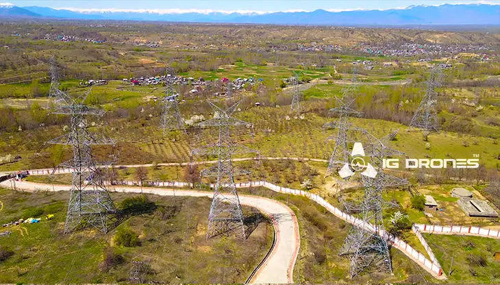
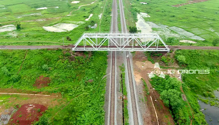
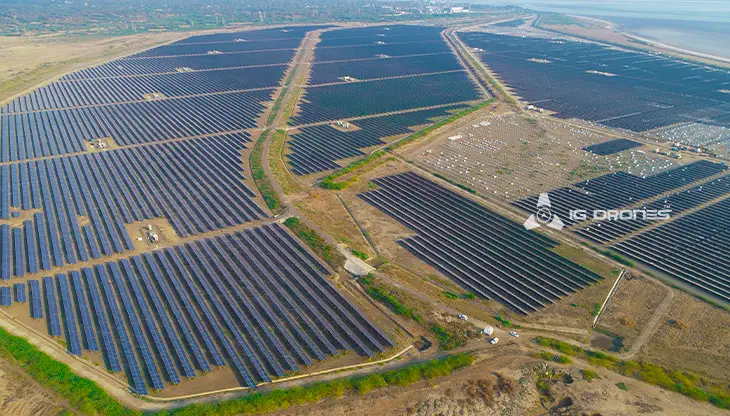
IG DRONES uses revolutionary drone technology to offer an adaptive and scalable end-to-end system. Our aerial surveying, mapping, and inspection services have aided the government and corporate sectors of the country in preserving assets to their full potential. Drone-based Powerline Monitoring, Industrial Inspection, Bridge Inspection, Solar Plant Inspection, Pipeline Inspection, Railway Services (Survey, Mapping & Inspection), Smart City Survey, Road Inspection, Mine Survey, Agricultural Survey, Forest & Wildlife Survey, Disaster Assessment, Wind Turbine Blades Inspection, Port Survey, Buildings & Skyscrapers Inspection, and Monuments Inspection are just a few of the services we provide.
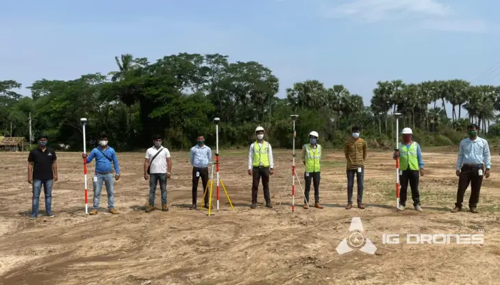
The goal of IG DRONES is to provide aerial drone surveying, mapping, and inspection services to clients all around the world. Our areas of expertise include land surveying, aerial surveys for land management and development, land slope monitoring, stockpile volumetric measurements, smart city design, greenfield project mapping, and other areas. IG Drones places a premium on precision, and as a result, it frequently creates centimetre-level topographic maps. Drone Data Processing is the most current advancement in geospatial technology, having drone applications in a variety of industries. Our clients receive their deliverables faster thanks to high-end surveying drones and a team of skilled licenced pilots. In Volumetric Measurements, Crop Yield Estimates, Damage Detection, and other areas, we continue to apply Artificial Intelligence and Machine Learning to achieve up to 99 percent accuracy. People are compelled to make decisions more quickly as a result.


Talk to our team if you have any questions about drone surveying for your industry.
Contact Us for Drone Services in Ladakh Contact UsIG Drones provide specialist drone services at height and difficult to access areas across India. Technical end-to-end solution to help you ease your operation. Capture the smallest of details with ease. Raise your operational standards & Imagine more with us. Imagine Inspire Innovate.
