
Kohima is the capital city of India's northeastern state of Nagaland. With a resident population of almost 100,000, it is the second largest city in the state.Kohima is served by the Dimapur Airport located in Dimapur, 74 kilometres (46 miles) from the city centre of Kohima. The Kohima Municipal Council (KMC) was established in 2005 under India's Constitution. The currently under construction Kohima Chiethu Airport once completed will serve as the main airport for the Greater Kohima Metropolitan Area.Kohima is not connected with the rail network. The nearest railway station is at Dimapur.Once completed the Kohima Zubza Railway Station will serve as the main railway station of Kohima.
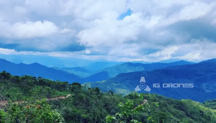
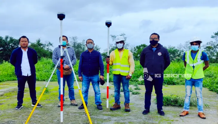
IG Drones was founded in 2018 with the goal of providing enterprise drone solutions across India and revolutionising traditional industrial procedures with highly efficient drones. It is one of Kohima, Nagaland's most well-known and top drone service companies. Drone surveying, mapping, and inspection services are provided by IG Drones in Kohima and the adjacent areas in the states of Assam, Arunachal Pradesh, Manipur, Meghalaya, Mizoram, Nagaland, Tripura, and Sikkim.


IG Drones is India's premier drone solutions provider, specialising in GIS survey, topographic survey, drone inspection, mapping, and powerline monitoring, Smart City Survey, Road Inspection & Survey, Mines Survey, Flood Assessment, Asset Monitoring, Solar Thermal Inspection, Security and Surveillance, Crop Health Monitoring, Volumetric Measurement, Drone 3D Mapping & Modelling, Aerial Photography & Videography and many moreusing advanced drone technology and providing meaningful data for businesses using the latest drone technology.IG Drones has been providing high-quality drone survey and mapping services in Kohima (Nagaland), Guwahati (Assam), Itanagar (Arunachal Pradesh), Dimapur (Nagaland), Agartala (Tripura), Imphal (Manipur), and Aizawal(Mizoram) since 2018.
Get in touch with IG DRONES to experience the India's best Drone Service Company first-hand
Contact Us!We have clients across Nagaland& other North-Eastern states like – Department of Atomic Energy (DAE), Indian Railways, North Eastern Railway,National Highway Authority of India(NHAI), PowerGrid, Coal India, NRRI, Sekura Energy Limited, Sekura Roads Limited, The World Bank, Reliance Power, Adani, Sekura, Indigrid, Transrail, Aditya Birla Hindalco, Aditya Birla Renewables, Navayuga Group, Indian Oil, HCL Foundation, Jakson Group, Creative Group, TRP Social Consultants, IL&FS, Humanitarian Aid International(HAI)etc.


.png)
.png)


.png)


At IG DRONES, we are always working on something new! We are proud of our latest work.
Some of our notable drone services across the industries include
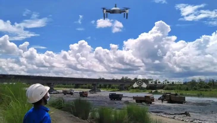
IG DRONES uses breakthrough drone technology to offer an adaptive and scalable end-to-end solution. Our aerial survey, mapping, and inspection services have aided the government and corporate sectors of the country in preserving assets to their full potential. We provide a variety of services, including drone-based powerline monitoring, industrial inspection, bridge inspection, solar plant inspection, pipeline inspection, railway services (survey, mapping, and inspection), Smart City Survey, road inspection, agricultural survey, forest & wildlife survey, disaster assessment, wind turbine blades inspection, buildings inspection, and monuments inspection.
Aerial Drone Surveying, Mapping, and Inspection services are provided by IG Drones throughout Kohima (Nagaland) and North-East India. We excel in a variety of industries, including land surveying, aerial surveys for land management and development, land slope monitoring, stockpile volumetric measurements, smart city design, greenfield project mapping, and others. Because IG Drones places a premium on accuracy, it routinely produces topographic maps with centimetre-level precision. Drone Data Processing is the latest geospatial technology trend, with drone applications spanning a wide range of sectors.Our clients receive their deliverables faster thanks to high-end surveying drones and a team of competent trained pilots. We continue to achieve up to 99 percent accuracy in Volumetric Measurements, Crop Yield Estimates, Damage Detection, and other areas using Artificial Intelligence and Machine Learning. This allows for faster decision-making and, without a doubt, helps clients get better outcomes from Drone Survey, Mapping, and Inspection in difficult-to-reach locations in North-East India.


Talk to our team if you have any questions about drone surveying for your industry.
Contact Us for Drone Services in Nagaland Contact UsIG Drones provide specialist drone services at height and difficult to access areas across India. Technical end-to-end solution to help you ease your operation. Capture the smallest of details with ease. Raise your operational standards & Imagine more with us. Imagine Inspire Innovate.
