
Jodhpur is the second-largest city in the Indian state of Rajasthan and officially the second metropolitan city of the state. It was formerly the seat of the princely state of Jodhpur State. Jodhpur was historically the capital of the Kingdom of Marwar, which is now part of Rajasthan. Jodhpur is a popular tourist destination, featuring many palaces, forts, and temples, set in the stark landscape of the Thar Desert. It is popularly known as the "Blue City" among people of Rajasthan and all over India. It serves as the administrative headquarters of the Jodhpur district and Jodhpur division. Jodhpur railway station (JU) is the divisional headquarters of the North Western Railways (NWR). In 2012-13 Railway Budget, A plan for building a High-Speed Rail Corridor between Delhi-Jodhpur via Jaipur and Ajmer of 591 km was introduced which later in 2020 was included in HSR by Indian Railways and Government of India and now is in Pre-Feasibility phase. Jodhpur is connected to the National Highway network with three national highways (NH 62, NH 112, NH 114) and to the Rajasthan State Highway network with 10 state highways.
Awarded as the India's Most Promising Drone Consultants, IG DRONES is now the leading drone service providers in India. IG Drones was founded in 2018 with the goal of providing enterprise drone solutions across India and revolutionising traditional industrial procedures with highly efficient drones. It is one of Jodhpur's top drone service providers. In the North Indian states of Jammu, Haryana, Punjab, Rajasthan, Uttarakhand, Himanchal Pradesh, Uttar Pradesh, and UT Chandigarh, IG Drones uses drones to deliver drone survey solutions, drone mapping, and inspection services in Jodhpur and the surrounding areas.


IG Drones is India’s leading Drone solutions company providing highly accurate & detailed GIS Survey, Topographic survey, Drone Inspection, Drone Mapping, Powerline Monitoring, Smart City Survey, Road Inspection & Survey, Mines Survey, Flood Assessment, Asset Monitoring, Solar Thermal Inspection, Security and Surveillance, Crop Health Monitoring, Volumetric Measurement, Drone 3D Mapping & Modelling, Aerial Photography & Videography and many more using advanced drone technology and providing meaningful data for businesses using the latest drone technology. Since 2018, IG Drones has been delivering high-quality drone survey and mapping services in Jodhpur and other regions in the states of Jodhpur (Rajasthan), Lucknow (Uttar Pradesh), Chandigarh (Haryana), Chandigarh (Punjab), Dehradun (Uttarakhand), Srinagar (Jammu).
Get in touch with IG DRONES to experience the India's best Drone Service Company first-hand
Contact Us!We have clients across Rajasthan & other Northern states like – Department of Atomic Energy (DAE), Institute of Plasma Research (IPR), Indian Railways, National Highway Authority of India(NHAI), PowerGrid, Coal India, Vadodara Smart City, Surat Metro, The World Bank, Reliance Power, Adani, Sekura, ReNew Power, Indigrid, Transrail, Aditya Birla Hindalco, Aditya Birla Renewables, Navayuga Group, Indian Oil, HCL Foundation, Jakson Group, IL&FS, MCL, Humanitarian Aid International(HAI) etc


.png)
.png)
.png)


At IG DRONES, we are always working on something new! We are proud of our latest work.
Some of our notable drone services across the industries include
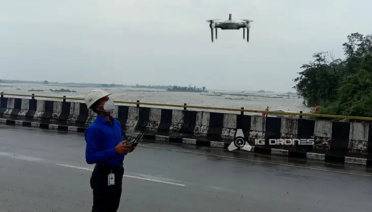
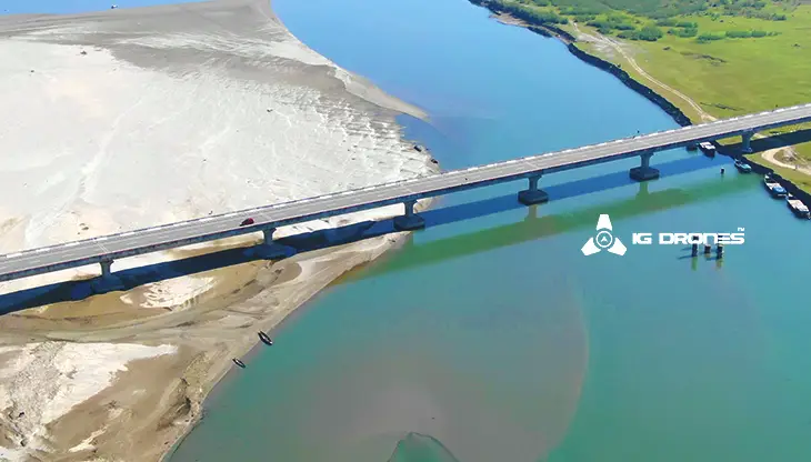
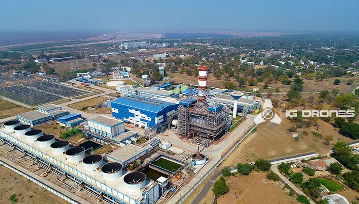
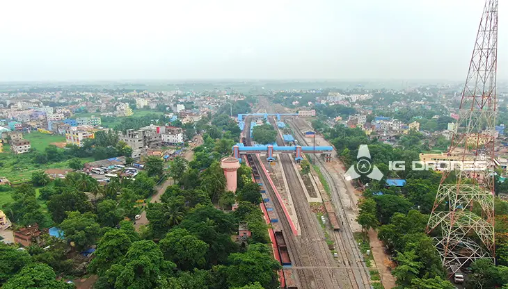
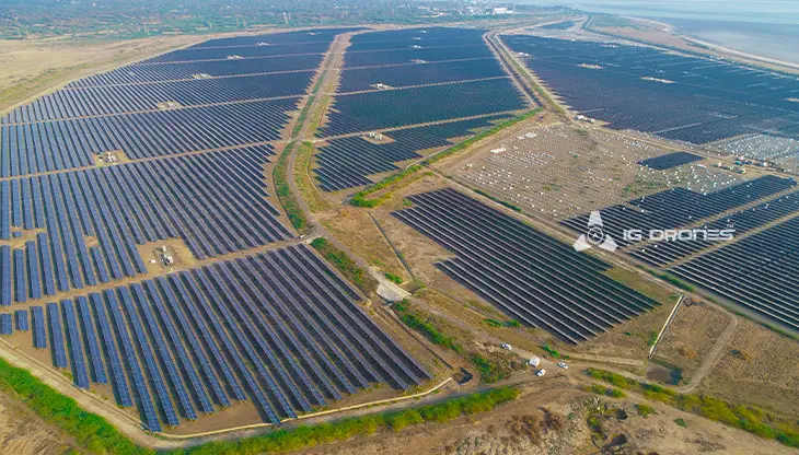
IG DRONES employs cutting-edge drone technology to develop an adaptive and scalable end-to-end solution. Our aerial survey, mapping, and inspection services have helped the country's government and corporate sectors preserve assets to their maximum potential. Drone-based Powerline Monitoring, Industrial Inspection, Bridge Inspection, Solar Plant Inspection, Pipeline Inspection, Railway Services (Survey, Mapping & Inspection), Smart City Survey, Road Inspection, Mine Survey, Agricultural Survey, Forest & Wildlife Survey, Disaster Assessment, Wind Turbine Blades Inspection, Port Survey, Buildings & Skyscrapers Inspection, and Monuments Inspection are just a few of the services available.
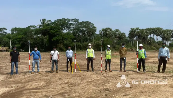
IG Drones' mission is to provide aerial drone surveying, mapping, and inspection services to clients worldwide. Land surveying, aerial surveys for land management and development, land slope monitoring, stockpile volumetric measurements, smart city design, greenfield project mapping, and other services are among our specialties. IG Drones prioritises accuracy and, as a result, regularly provides highly accurate topographic maps with centimetre-level precision. Drone Data Processing is the most recent geospatial technology trend, with drone applications spanning many industries. Because of high-end surveying drones and a team of skilled licenced pilots, our clients receive their deliverables faster. Using Artificial Intelligence and Machine Learning, we continue to achieve up to 99 percent accuracy in Volumetric Measurements, Crop Yield Estimates, Damage Detection, and other areas. As a result, people are pushed to make decisions more quickly.


Talk to our team if you have any questions about drone surveying for your industry.
Contact Us for Drone Services in Rajasthan Contact UsIG Drones provide specialist drone services at height and difficult to access areas across India. Technical end-to-end solution to help you ease your operation. Capture the smallest of details with ease. Raise your operational standards & Imagine more with us. Imagine Inspire Innovate.
