
Imphal is the capital city of the Indian state of Manipur. The metropolitan centre of the city contains the ruins of Kangla Palace (also known as Kangla Fort), the royal seat of the former Kingdom of Manipur, surrounded by a moat. Spread over parts of the districts of Imphal West and Imphal East, the former contains the majority of the city's area and population. Imphal is part of the Smart Cities Mission under the Ministry of Housing and Urban Affairs. Manipur State Power Distribution Company Limited is responsible for electricity supply in the city. Public Health and Engineering Department of the Manipur Government looks after both water supply, and sewage and drainage in Imphal. Roads in the city are developed and maintained by the state Public Works Department. Imphal Municipal Corporation is responsible for Solid Waste Management. The state Department of Fire Services provides fire safety services in the city with one fire station, which is also the department headquarters.
In 2018, IG DRONES was established with an aim to provide enterprise drone solutions PAN India and revolutionise the conventional industrial methods using highly efficient drones. It is one of the most well-known & leading drone service providers in Imphal, Manipur. IG Drones uses drones to deliver drone survey solutions, drone mapping, and inspection services in Imphal & the surrounding areas in the states of Assam, Arunachal Pradesh, Meghalaya, Mizoram, Nagaland, Tripura & Sikkim.


IG Drones is India’s leading Drone solutions company providing highly accurate & detailed GIS Survey, Topographic survey, Drone Inspection, Drone Mapping, Powerline Monitoring, Smart City Survey, Road Inspection & Survey, Mines Survey, Flood Assessment, Asset Monitoring, Solar Thermal Inspection, Security and Surveillance, Crop Health Monitoring, Volumetric Measurement, Drone 3D Mapping & Modelling, Aerial Photography & Videography and many more using advanced drone technology and providing meaningful data for businesses using the latest drone technology. Since 2018, IG Drones has been delivering high-quality drone survey and mapping services in Imphal (Manipur) and other regions of Guwahati (Assam), Itanagar (Arunachal Pradesh), Kohima (Nagaland), Imphal (Manipur), Shillong (Meghalaya), Agartala (Tripura), Aizawal (Mizoram).
Get in touch with IG DRONES to experience the India's best Drone Service Company first-hand
Contact Us!We have clients across Manipur & other North-Eastern states like – Department of Atomic Energy (DAE), Indian Railways, North Eastern Railway, National Highway Authority of India (NHAI), PowerGrid, Coal India, NRRI, Sekura Energy Limited, Sekura Roads Limited, The World Bank, Reliance Power, Adani, Sekura, Indigrid, Transrail, Aditya Birla Hindalco, Aditya Birla Renewables, Navayuga Group, Indian Oil, HCL Foundation, Jakson Group, Creative Group, TRP Social Consultants, IL&FS, Humanitarian Aid International(HAI) etc.


.png)
.png)


.png)


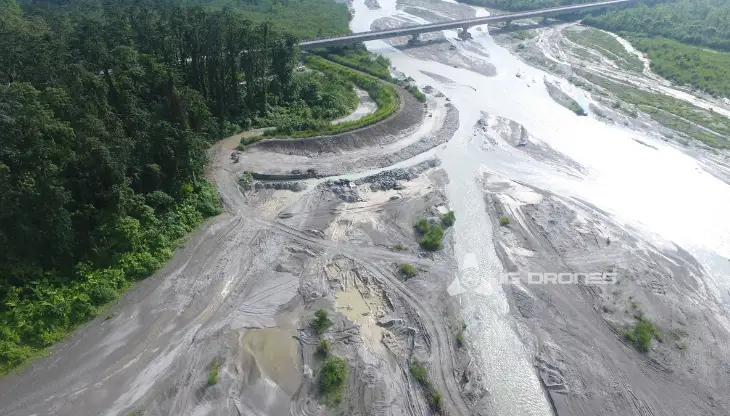
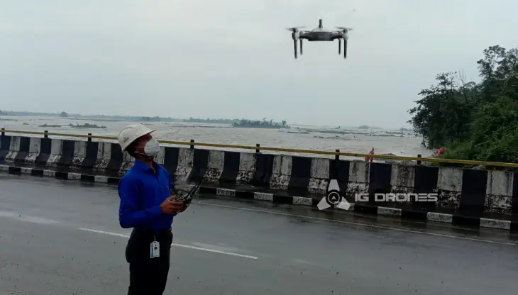
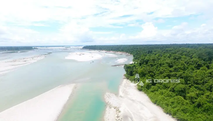
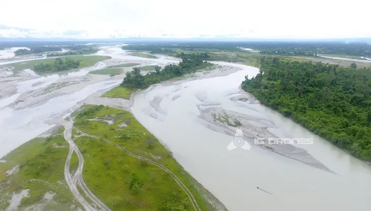
At IG DRONES, we are always working on something new! We are proud of our latest work.
Some of our notable drone services across the industries include

IG DRONES creates an adaptive and scalable end-to-end solution by exploiting revolutionary Drone technology. Our Aerial Survey, Mapping, and Inspection Services have helped the country's government and corporate sectors preserve assets to their maximum potential. Drone-based powerline monitoring, industrial inspection, bridge inspection, solar plant inspection, pipeline inspection, railway services (survey, mapping, and inspection), Smart City Survey, road inspection, mine survey, agricultural survey, forest & wildlife survey, disaster assessment, wind turbine blades inspection, buildings inspection, and monuments inspection are just a few of the services we provide.
IG Drones aims to provide Aerial Drone Surveying, Mapping & Inspection services throughout Imphal (Manipur) & all of North-East India. Land surveying, aerial surveys for land management and development, land slope monitoring, stockpile volumetric measurements, smart city design, greenfield project mapping, and other fields are all areas where we excel. IG Drones prioritises quality, and as a result, it routinely provides very accurate topographic maps with centimetre-level precision. Drone Data Processing is the newest trend in geospatial technology, with drone applications spanning a wide range of industries. Thanks to high-end surveying drones and a team of skilled certified pilots, our clients get their deliverables sooner. Using Artificial Intelligence and Machine Learning, we continue to achieve up to 99 percent accuracy in Volumetric Measurements, Crop Yield Estimates, Damage Detection, and other areas. This supports quicker decision-making and undoubtedly aids clients in obtaining better results from Drone Survey, Mapping, and Inspection in North-East India's difficult-to-reach areas.


Talk to our team if you have any questions about drone surveying for your industry.
Contact Us for Drone Services in Manipur Contact UsIG Drones provide specialist drone services at height and difficult to access areas across India. Technical end-to-end solution to help you ease your operation. Capture the smallest of details with ease. Raise your operational standards & Imagine more with us. Imagine Inspire Innovate.
