
Gandhidham is the developed, largest and most populous city in Kutch District, Gujarat, India. It was created in the early 1950s for the resettlement of Sindhi Hindu refugees from Sindh (now in Pakistan) in the aftermath of the partition of India. It was named after Mahatma Gandhi, the father of the Indian nation. An economic capital of Kutch and a growing area for families and retirees, it is Gujarat's 8th most populous city. It is a popular destination for conventions, business and meetings. Today Adipur and Gandhidham townships are the townships of pride in the District of Kachchh only with the grace of Rajput Kshatriya ancestors – Provided by Ram Amarnani.
Awarded as the India's Most Promising Drone Consultants, IG DRONES is now the leading drone service providers in India. IG Drones was founded in 2018 with the goal of providing enterprise drone solutions across India and revolutionising traditional industrial procedures with highly efficient drones to revolutionise old industrial practises. It is a leading drone service provider in Gandhidham. IG Drones employs drones to give drone survey solutions, drone mapping, and inspection services in Gandhidham and the neighbouring areas in the West Indian states of Rajasthan, Gujarat, Maharashtra, Madhya Pradesh, Goa.


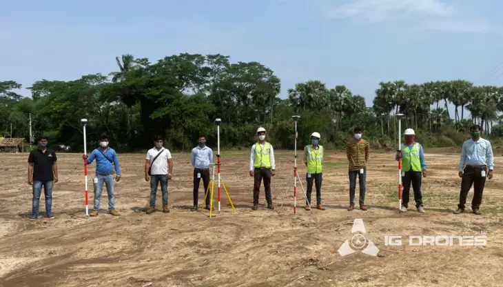
IG Drones is India’s leading Drone Service provider company providing highly accurate & detailed GIS Survey, Topographic survey, Drone Inspection, Drone Mapping, Powerline Monitoring, Smart City Survey, Road Inspection & Survey, Mines Survey, Flood Assessment, Asset Monitoring, Solar Thermal Inspection, Security and Surveillance, Crop Health Monitoring, Volumetric Measurement, Drone 3D Mapping & Modelling, Aerial Photography & Videography and many more using advanced drone technology and providing meaningful data for businesses using the latest drone technology. Since 2018, IG Drones has been delivering high-quality drone survey and mapping services in Gandhidham (Gujarat) and other regions in the states of Jaipur (Rajasthan), Mumbai (Maharashtra), Panjim (Goa), UT Daman & Diu and Dadra & Nagar Haveli.
Get in touch with IG DRONES to experience the India's best Drone Service Company first-hand
Contact Us!We have clients across Gujarat like – Department of Atomic Energy (DAE), Institute of Plasma Research (IPR), Indian Railways, National Highway Authority of India(NHAI), PowerGrid, Coal India, Vadodara Smart City, Surat Metro, The World Bank, Reliance Power, Adani, Sekura, ReNew Power, Indigrid, Transrail, Aditya Birla Hindalco, Aditya Birla Renewables, Navayuga Group, Indian Oil, HCL Foundation, Jakson Group, IL&FS, MCL, Humanitarian Aid International(HAI) etc

.png)


.png)
.png)

.png)


At IG DRONES, we are always working on something new! We are proud of our latest work.
Some of our notable drone services across the industries include
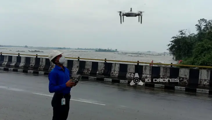
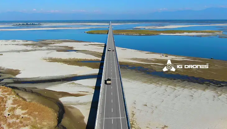
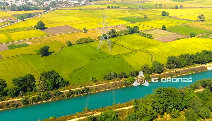
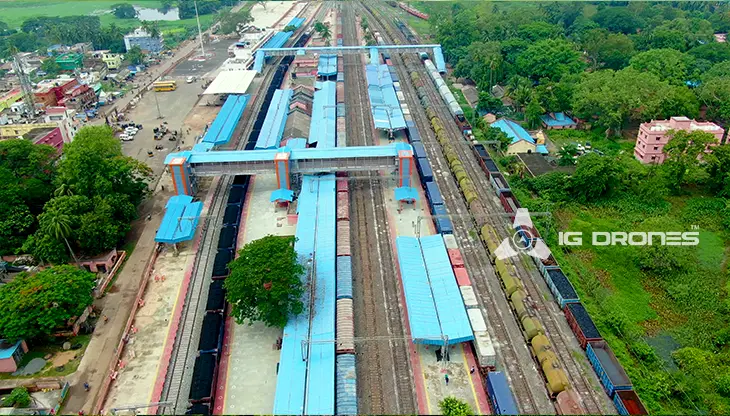
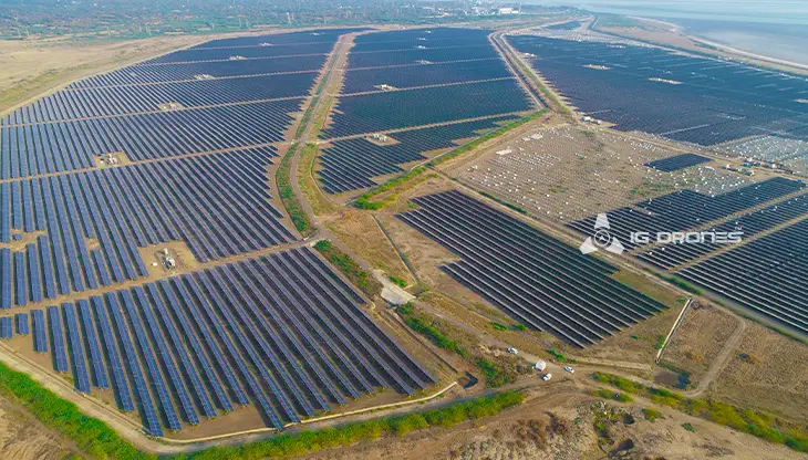
IG DRONES employs cutting-edge drone technology to develop an adaptive and scalable end-to-end solution. Our aerial survey, mapping, and inspection services have helped the country's government and corporate sectors preserve assets to their maximum potential. Drone-based Powerline Monitoring, Industrial Inspection, Bridge Inspection, Solar Plant Inspection, Pipeline Inspection, Railway Services (Survey, Mapping & Inspection), Smart City Survey, Road Inspection, Mine Survey, Agricultural Survey, Forest & Wildlife Survey, Disaster Assessment, Wind Turbine Blades Inspection, Port Survey, Buildings & Skyscrapers Inspection, and Monuments Inspection are just a few of the services available.
IG Drones' mission is to provide aerial drone surveying, mapping, and inspection services to clients worldwide. Land surveying, aerial surveys for land management and development, land slope monitoring, stockpile volumetric measurements, smart city design, greenfield project mapping, and other services are among our specialties. IG Drones prioritises accuracy and, as a result, regularly provides highly accurate topographic maps with centimetre-level precision. Drone Data Processing is the most recent geospatial technology trend, with drone applications spanning many industries. Because of high-end surveying drones and a team of skilled licenced pilots, our clients receive their deliverables faster. Using Artificial Intelligence and Machine Learning, we continue to achieve up to 99 percent accuracy in Volumetric Measurements, Crop Yield Estimates, Damage Detection, and other areas. As a result, people are pushed to make decisions more quickly.


Talk to our team if you have any questions about drone surveying for your industry.
Contact Us for Drone Services in Gujarat Contact UsIG Drones provide specialist drone services at height and difficult to access areas across India. Technical end-to-end solution to help you ease your operation. Capture the smallest of details with ease. Raise your operational standards & Imagine more with us. Imagine Inspire Innovate.
