
Erode is one of the most important cities of Tamil Nadu and it is the administrative headquarters of the Erode district. The city is located on the banks of River Kaveri and known for its power loom and hand loom products. Due to the abundance of the textile business, Erode is also known as the ‘Loom City” or “Textile City” of India. It is one of the most important business centers of South India. There are a number of government educational institutions present in Erode. Erode was a part of the Coimbatore District and was separated in the year 1979. The city is well connected by roads and several state highways like SH-15, SH-37, SH-84 and SH-84A are some of the important highways that pass through the city. The nearest airport is Coimbatore Airport which flies both domestic and international flights.
IG Drones, on being rewarded as India's Most Promising Drone Consultants, is currently the leading drone service provider of India. IG Drones initially came into existence in 2018, with an aim to provide enterprise drone solutions all over India and revolutionize traditional industrial procedures with efficient drones. IG Drones have been awarded as “Airwards's Best Drone Organisation-Startup”. It is because of our consistency in Pre and Post Disaster Assessments and constant efforts in Search and Rescue Operations that we as a team have successfully reached up to this stage. IG Drones is one of Erode’s top drone service providers. In various other South Indian states as well, IG Drones are of great service in order to deliver drone survey solutions, drone mapping, and inspection services. In line with government missions, it is also accountable for training and enhancing of the abilities of India's youth, further preparing them for the oncoming Industrial 4.0 Revolution. The IG Drones Drone Center of Excellence (CoE) is a programme that was established to educate more than 10 million students about the latest drone technologies.


IG drones provides enumerable services such as GIS Survey, Topographic Survey, Drone Inspection, Drone Mapping, Power line Monitoring, Smart City Survey, Road Inspection & Survey, Mines Survey, Flood Assessment, Asset Monitoring, Solar Thermal Inspection, Security and Surveillance, Crop Health Monitoring, Volumetric Measurement, and Drone 3D Mapping & Modelling. Since 2018, IG Drones has been generating high-quality drone surveys and mapping services in Erode (Tamil Nadu) and other Southern regions in Visakhapatnam (Andhra Pradesh) Mysore(Karnataka) RAICHUR-KURNOOL (Andhra Pradesh) NAIDUPETA, (Andhra Pradesh) Roing (Arunachal Pradesh) Bangalore(Karnataka) Mysore (Karnataka) (Ooty) Tamil Nadu (Auroville) Tamil Nadu
Get in touch with IG DRONES to experience the India's best Drone Service Company first-hand
Contact Us!We have clients across Erode Tamil Nadu & other Southern Regions on like – G R Infraprojects Limited , Andhra Pradesh Forest Department , Geocon Surveys , Kudgi Narendra Transmission Line Sekura Roads, KEC International , ITC Limited, CK Rajan Engineering Contractor , CPWD , Andhra Pradesh Forest Department


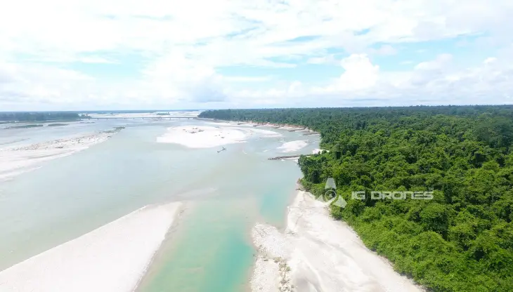
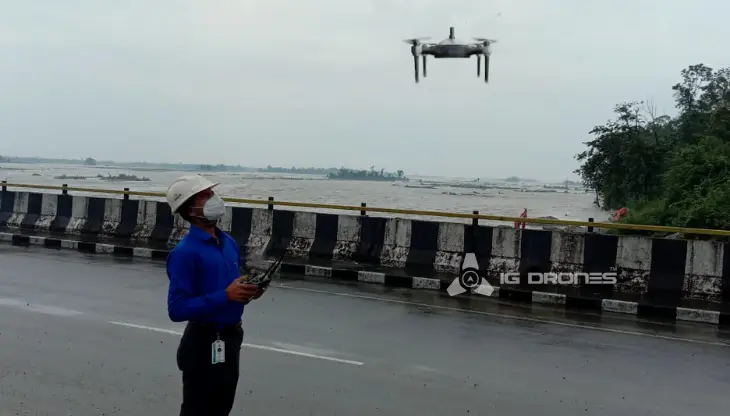
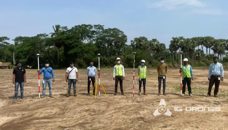
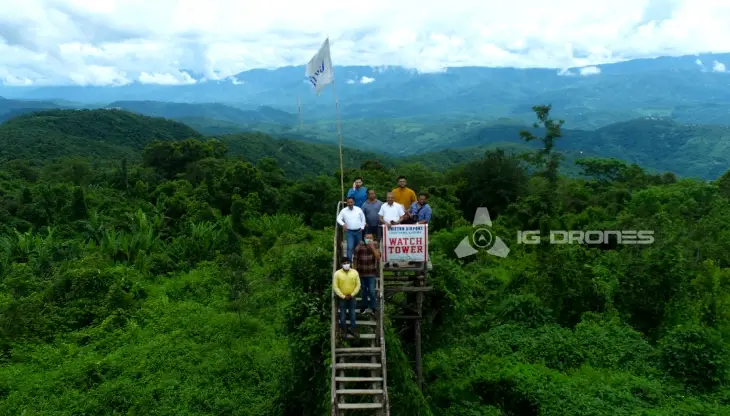
At IG DRONES, we are always working on something new! We are proud of our latest work.
Some of our notable drone services across the industries include
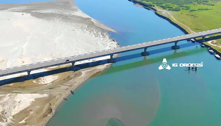
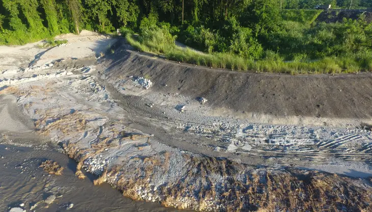
IG DRONES is a famous firm that provides a bespoke, flexible and an end-to-end solution, using cutting-edge drone technology. We cover various fields such as aerial surveying, mapping, and inspection services to aid the government and corporate sectors of the country for prevention of assets up to their full potential. Drone-based power line monitoring, industrial inspection, bridge inspection, solar plant inspection, pipeline inspection, railway services (survey, mapping, and inspection), smart city survey, road survey, mine survey, agricultural survey, forest and wildlife survey, disaster assessment, wind turbine blades inspection, port survey, buildings & skyscrapers inspection, and monuments inspection are mere services that we provide.
IG Drones provides airborne drone surveying, mapping, and inspection services to clients globally. IG Drones has also provided numerous services in land surveying, aerial surveys for land management and development, land slope monitoring, stockpile volumetric measurements, smart city design, green field project mapping, and other areas of expertise. Since IG Drones has conquered all fields and established a great significance on precision, it often generates centimeter-level topographic maps. Drone Data Processing is the most recent geospatial technology innovation, and drones are used in numerous businesses. Special gratitude to our high-end surveying drones and a team of skilled licenced pilots because of whom our clients get their deliveries sooner than expected. We continue to use Artificial Intelligence and Machine Learning to climb up to 99 percent accuracy in volumetric measurements, crop yield estimates, damage detection, and other areas and hence, people are bound to make decisions in a rapid way.


Talk to our team if you have any questions about drone surveying for your industry.
Contact Us for Drone Services in Tamil Nadu Contact UsIG Drones provide specialist drone services at height and difficult to access areas across India. Technical end-to-end solution to help you ease your operation. Capture the smallest of details with ease. Raise your operational standards & Imagine more with us. Imagine Inspire Innovate.
