
Dehradun is the capital and the largest city of the Indian state of Uttarakhand. Dehradun is located in the Doon Valley on the foothills of the Himalayas nestled between Song River, a tributary of Ganga on the east and the Asan river, a tributary of Yamuna on the west. Dehradun is a notable academic and research hub and is home to the Indian Military Academy, Forest Research Institute, Indira Gandhi National Forest Academy, The Doon School, Welham Boys School, Welham Girls School, Rashtriya Indian Military College, Uttarakhand Ayurveda University, Wadia Institute of Himalayan Geology, and the Indian Institute of Remote Sensing. It is the headquarters of the Surveyor- General of India.
Awarded as the India's Most Promising Drone Consultants,IG DRONES is now the leading drone service providers in India. IG Drones was created in 2018 with the purpose of delivering enterprise drone solutions across India and using highly efficient drones to revolutionise old industrial practises. It is a leading drone service provider in Dehradun. IG Drones employs drones to give drone survey solutions, drone mapping, and inspection services in Dehradun and the neighbouring areas in the North Indian states of Jammu, Haryana, Uttarakhand, Rajasthan, Uttarakhand, Himachal Pradesh, Uttar Pradesh, and UT Chandigarh.


IG Drones is India’s leading Drone Service provider company providing highly accurate & detailed GIS Survey, Topographic survey, Drone Inspection, Drone Mapping, Powerline Monitoring, Smart City Survey, Road Inspection & Survey, Mines Survey, Flood Assessment, Asset Monitoring, Solar Thermal Inspection, Security and Surveillance, Crop Health Monitoring, Volumetric Measurement, Drone 3D Mapping & Modelling, Aerial Photography & Videography and many more using advanced drone technology and providing meaningful data for businesses using the latest drone technology. Since 2018, IG Drones has been delivering high-quality drone survey and mapping services in Dehradun (Uttarakhand) and other regions in the states of Lucknow (Uttar Pradesh), Chandigarh (Haryana), Shimla (Himachal Pradesh), Jaipur (Rajasthan), Chandigarh (Punjab), Srinagar (Jammu).
Get in touch with IG DRONES to experience the India's best Drone Service Company first-hand
Contact Us!We have clients across Uttarakhand & other Northern states like – Department of Atomic Energy (DAE), Indian Railways, Northern Railways, National Disaster Management Authority(NDMA), National Highway Authority of India (NHAI), PowerGrid, Delhi Integrated Multi-Modal Transit System (DIMTS) Ltd., NRRI, Delhi Development Authority(DDA), Delhi Transco Limited (DTL), Adani, The World Bank, Reliance Power, Adani Transmission, Sekura, Indigrid, Transrail, Aditya Birla Hindalco, Aditya Birla Renewables, Navayuga Group, Indian Oil Corporation, HCL Foundation, Jakson Group, IL&FS, Humanitarian Aid International(HAI) etc.


.png)
.png)

.png)


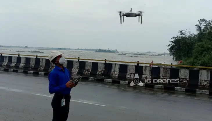
At IG DRONES, we are always working on something new! We are proud of our latest work.
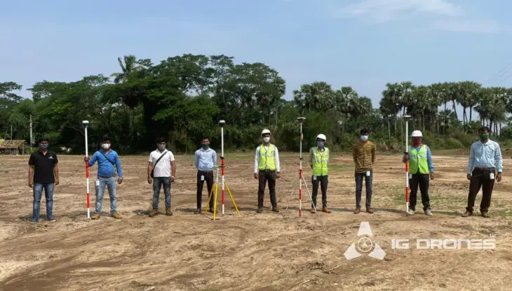
Some of our notable drone services across the industries include
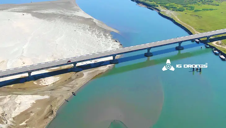
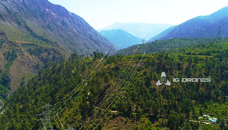
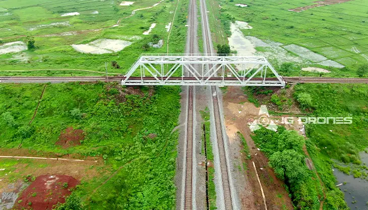
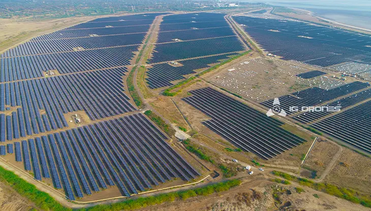
IG DRONES uses revolutionary drone technology to create an adaptive and scalable end-to-end solution. Our aerial survey, mapping, and inspection services have aided the government and corporate sectors of the country in preserving assets to their full potential. Drone-based Powerline Monitoring, Industrial Inspection, Bridge Inspection, Solar Plant Inspection, Pipeline Inspection, Railway Services (Survey, Mapping & Inspection), Smart City Survey, Road Inspection, Mine Survey, Agricultural Survey, Forest & Wildlife Survey, Disaster Assessment, Wind Turbine Blades Inspection, Port Survey, Buildings & Skyscrapers Inspection, and Monuments Inspection are just a few of the services we provide.
The mission of IG Drones is to provide aerial drone surveying, mapping, and inspection services to clients around the world. We excel in a variety of fields, including land surveying, aerial surveys for land management and development, land slope monitoring, stockpile volumetric measurements, smart city design, greenfield project mapping, and others. IG Drones places a premium on accuracy, and as a result, provides highly accurate topographic maps with centimetre-level precision on a regular basis. Drone Data Processing is the latest geospatial technology trend, with drone applications spanning a wide range of industries. Our clients receive their deliverables faster thanks to high-end surveying drones and a team of skilled licenced pilots. We continue to achieve up to 99 percent accuracy in Volumetric Measurements, Crop Yield Estimates, Damage Detection, and other areas using Artificial Intelligence and Machine Learning. People are pushed to make decisions more quickly as a result of this.


Talk to our team if you have any questions about drone surveying for your industry.
Contact Us for Drone Services in Uttarakhand Contact UsIG Drones provide specialist drone services at height and difficult to access areas across India. Technical end-to-end solution to help you ease your operation. Capture the smallest of details with ease. Raise your operational standards & Imagine more with us. Imagine Inspire Innovate.
