
Chennai is located on the Coromandel Coast along the Bay of Bengal. The Cooum (Koovam) River flows through its centre and the Adyar River through its southern portion. The Buckingham Canal runs parallel to the coast, joining the Kortalaiyar (Kosasthalaiyar) River in the northern edges of the city and the Muttukadu Backwaters south of the city. The most distinctive buildings in the city are the seven large temples in the Dravidian style, situated in the city sections of George Town, Mylapore, and Triplicane. The Chepauk Palace (the former residence of the nawab [Mughal ruler] of Karnataka) and the University Senate House, both in the Deccan Islamic style, and the Victoria Technical Institute and the High Court buildings, both in the Indo-Saracenic style, are generally considered the most attractive buildings of the British period.
On being rewarded as being India's Most Promising Drone Consultants, IG Drones is now a leading drone service provider of India. IG Drones was established in 2018 and it aimed at providing enterprise drone solutions across India and revolutionizing traditional industrial procedures with high quality efficient drones. IG Drones is one of Chennai’s top drone service providers. In various other South Indian states as well, IG Drones deliver drone survey solutions, drone mapping, and inspection services. IG Drones have been awarded as “Airwards's Best Drone Organisation-Startup”. It is because of our consistency in Pre and Post Disaster Assessments and constant efforts in Search and Rescue Operations that we as a team have successfully reached up to this stage. In line with government missions, it is responsible for the training and enhancing of the abilities of India's youth to prepare them for the oncoming Industrial 4.0 Revolution. The IG Drones Drone Center of Excellence (CoE) is a program that was established with an aim of educating more than 10 million students about the newest drone technologies.


IG drones provides enumerable services such as GIS Survey, Topographic Survey, Drone Inspection, Drone Mapping, Power line Monitoring, Smart City Survey, Road Inspection & Survey, Mines Survey, Flood Assessment, Asset Monitoring, Solar Thermal Inspection, Security and Surveillance, Crop Health Monitoring, Volumetric Measurement, and Drone 3D Mapping & Modelling. Since 2018, IG Drones has been generating high-quality drone surveys and mapping services in Chennai (Tamil Nadu) and other Southern regions in Visakhapatnam (Andhra Pradesh) Mysore(Karnataka) RAICHUR-KURNOOL (Andhra Pradesh) NAIDUPETA, (Andhra Pradesh) Roing (Arunachal Pradesh) Bangalore(Karnataka) Mysore (Karnataka) (Ooty) Tamil Nadu (Auroville) Tamil Nadu
Get in touch with IG DRONES to experience the India's best Drone Service Company first-hand
Contact Us!We have clients across Chennai Tamil Nadu & other Southern Regions on like – G R Infraprojects Limited , Andhra Pradesh Forest Department , Geocon Surveys , Kudgi Narendra Transmission Line Sekura Roads, KEC International , ITC Limited, CK Rajan Engineering Contractor , CPWD , Andhra Pradesh Forest Department


At IG DRONES, we are always working on something new! We are proud of our latest work.
Some of our notable drone services across the industries include
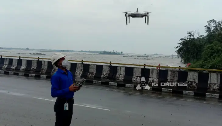
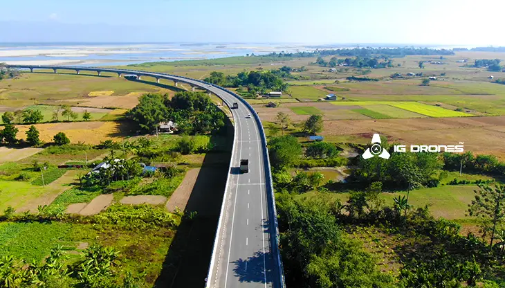
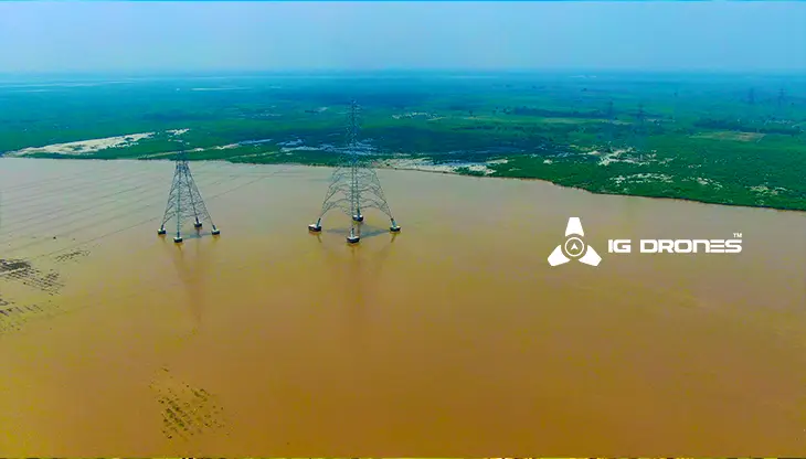
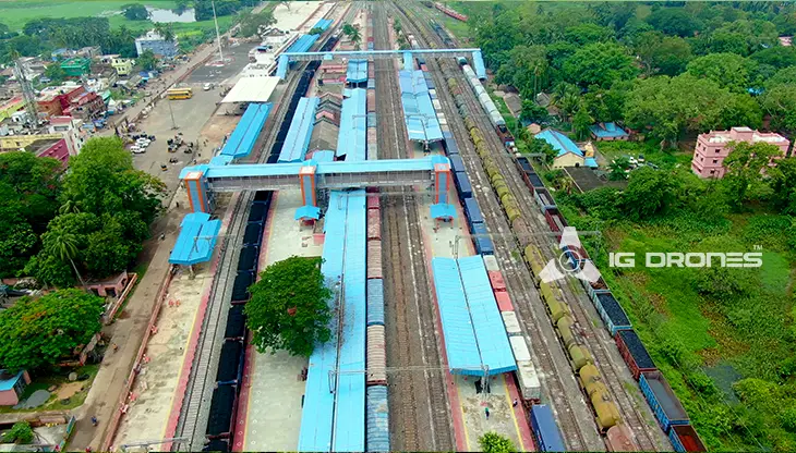
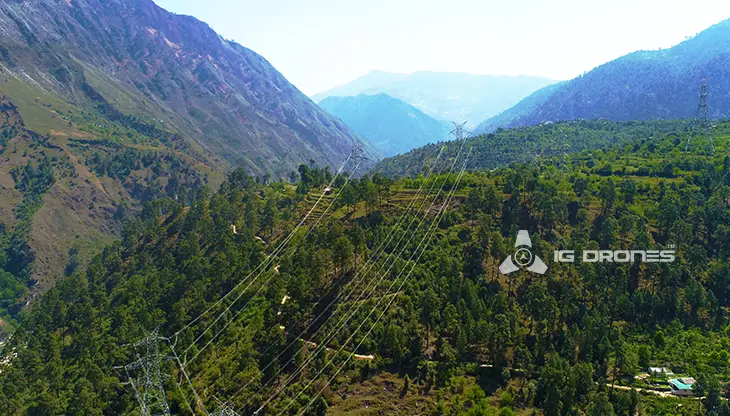
IG DRONES is a famous and well-established drone company that provides a bespoke, flexible and an end-to-end solution, using cutting-edge drone technology. We cover a great mass of fields such as aerial surveying, mapping, and inspection services to help the government and corporate sectors of the country to prevent assets up to their full potential. Drone-based power line monitoring, industrial inspection, bridge inspection, solar plant inspection, pipeline inspection, railway services (survey, mapping, and inspection), smart city survey, road survey, mine survey, agricultural survey, forest and wildlife survey, disaster assessment, wind turbine blades inspection, port survey, buildings & skyscrapers inspection, and monuments inspection are just a few among the multiple services that we provide.
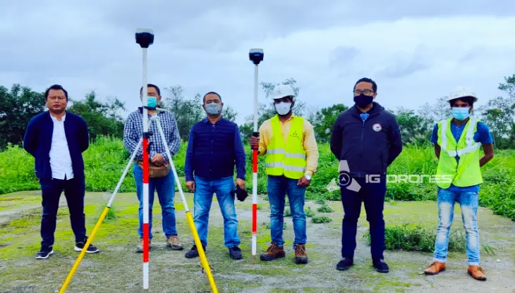
IG Drones aims to provide airborne drone surveying, mapping, and inspection services to clients globally. IG Drones has successfully provided numerous services in land surveying, aerial surveys for land management and development, land slope monitoring, stockpile volumetric measurements, smart city design, green field project mapping, and other areas of expertise. Since IG Drones have conquered all fields and established a great significance on precision, it often produces centimeter-level topographic maps. Drone Data Processing is the most recent geospatial technology innovation, and drones are used in numerous businesses. Special gratitude to our high-end surveying drones and a team of skilled licensed pilots since it is due to their hard work that our clients get their deliveries sooner than expected. We continue to use Artificial Intelligence and Machine Learning to climb up to 99 percent accuracy in volumetric measurements, crop yield estimates, damage detection, and other areas and hence, people are compelled to make decisions in a rapid way.


Talk to our team if you have any questions about drone surveying for your industry.
Contact Us for Drone Services in Tamil Nadu Contact UsIG Drones provide specialist drone services at height and difficult to access areas across India. Technical end-to-end solution to help you ease your operation. Capture the smallest of details with ease. Raise your operational standards & Imagine more with us. Imagine Inspire Innovate.
