
Bhuj is a Municipality and District Headquarters of Kutch District in the state of Gujarat, India. Bhuj is home to one of the first Swaminarayan Sampraday temples, built in 1822. Bhuj temple is one of the six original temples built during the earthly presence of the Lord Swaminarayan. Bhuj has an average elevation of 110 metres (360 feet). On the eastern side of the city is a hill known as Bhujia Hill, on which there is a Bhujia Fort, that separates Bhuj city and Madhapar town (considered one of the richest villages in Asia). It has two lakes namely Hamirsar and Deshadsar. Bhuj is connected to Ahmedabad, Vadodara, Surat Mumbai, Delhi, Kolkata, Pune, Gaziabad, Jaipur, Ajmer, Hapur, Moradabad, Bareilly, Kharagpur, Ujjain and other cities within India by railway.
Awarded as the India's Most Promising Drone Consultants, IG DRONES is now the leading drone service providers in India. IG Drones was founded in 2018 with the goal of providing enterprise drone solutions across India and revolutionising traditional industrial procedures with highly efficient drones to revolutionise old industrial practises. It is a leading drone service provider in Bhuj. IG Drones employs drones to give drone survey solutions, drone mapping, and inspection services in Bhuj and the neighbouring areas in the West Indian states of Rajasthan, Gujarat, Maharashtra, Madhya Pradesh, Goa.


IG Drones is India’s leading Drone Service provider company providing highly accurate & detailed GIS Survey, Topographic survey, Drone Inspection, Drone Mapping, Powerline Monitoring, Smart City Survey, Road Inspection & Survey, Mines Survey, Flood Assessment, Asset Monitoring, Solar Thermal Inspection, Security and Surveillance, Crop Health Monitoring, Volumetric Measurement, Drone 3D Mapping & Modelling, Aerial Photography & Videography and many more using advanced drone technology and providing meaningful data for businesses using the latest drone technology. Since 2018, IG Drones has been delivering high-quality drone survey and mapping services in Bhuj (Gujarat) and other regions in the states of Jaipur (Rajasthan), Mumbai (Maharashtra), Panjim (Goa), UT Daman & Diu and Dadra & Nagar Haveli.
Get in touch with IG DRONES to experience the India's best Drone Service Company first-hand
Contact Us!We have clients across Gujarat like – Department of Atomic Energy (DAE), Institute of Plasma Research (IPR), Indian Railways, National Highway Authority of India(NHAI), PowerGrid, Coal India, Vadodara Smart City, Surat Metro, The World Bank, Reliance Power, Adani, Sekura, ReNew Power, Indigrid, Transrail, Aditya Birla Hindalco, Aditya Birla Renewables, Navayuga Group, Indian Oil, HCL Foundation, Jakson Group, IL&FS, MCL, Humanitarian Aid International(HAI) etc

.png)


.png)
.png)


.png)


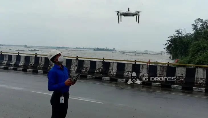
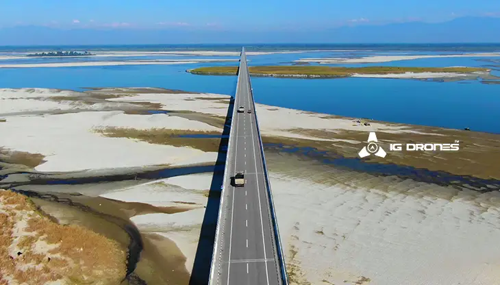
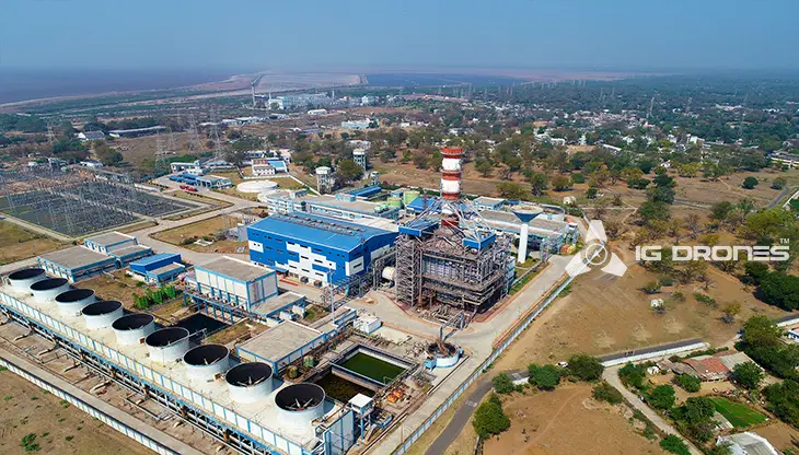
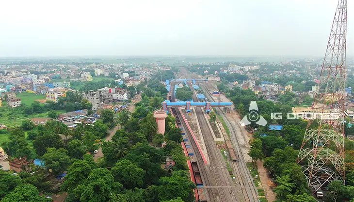
At IG DRONES, we are always working on something new! We are proud of our latest work.
Some of our notable drone services across the industries include
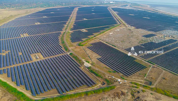
IG DRONES employs cutting-edge drone technology to develop an adaptive and scalable end-to-end solution. Our aerial survey, mapping, and inspection services have helped the country's government and corporate sectors preserve assets to their maximum potential. Drone-based Powerline Monitoring, Industrial Inspection, Bridge Inspection, Solar Plant Inspection, Pipeline Inspection, Railway Services (Survey, Mapping & Inspection), Smart City Survey, Road Inspection, Mine Survey, Agricultural Survey, Forest & Wildlife Survey, Disaster Assessment, Wind Turbine Blades Inspection, Port Survey, Buildings & Skyscrapers Inspection, and Monuments Inspection are just a few of the services available.
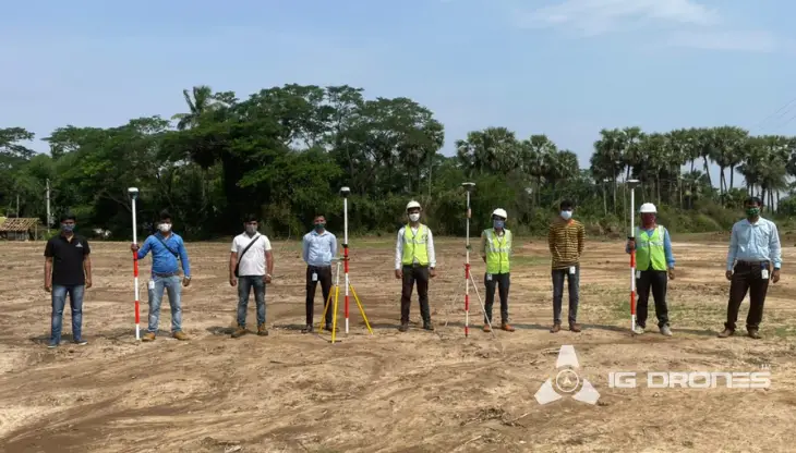
IG Drones' mission is to provide aerial drone surveying, mapping, and inspection services to clients worldwide. Land surveying, aerial surveys for land management and development, land slope monitoring, stockpile volumetric measurements, smart city design, greenfield project mapping, and other services are among our specialties. IG Drones prioritises accuracy and, as a result, regularly provides highly accurate topographic maps with centimetre-level precision. Drone Data Processing is the most recent geospatial technology trend, with drone applications spanning many industries. Because of high-end surveying drones and a team of skilled licenced pilots, our clients receive their deliverables faster. Using Artificial Intelligence and Machine Learning, we continue to achieve up to 99 percent accuracy in Volumetric Measurements, Crop Yield Estimates, Damage Detection, and other areas. As a result, people are pushed to make decisions more quickly.


Talk to our team if you have any questions about drone surveying for your industry.
Contact Us for Drone Services in Gujarat Contact UsIG Drones provide specialist drone services at height and difficult to access areas across India. Technical end-to-end solution to help you ease your operation. Capture the smallest of details with ease. Raise your operational standards & Imagine more with us. Imagine Inspire Innovate.
