
Belagavi, also known as “Venugrama” or the “Bamboo Village” is a city in the Indian state of Karnataka. It is the administrative headquarters of the eponymous Belagavi division and Belagavi district. It is also called as the second capital for the state of Karnataka .The most ancient place in the district is Halsi and this, according to inscriptions on copper plates discovered in its neighborhood, was once the capital of a dynasty of nine Kadamba kings. It appears that from the middle of the 6th century to about 760 the area was held by the Chalukyas, who were succeeded by the Rashtrakutas. After the break-up of the Rashtrakuta power a portion of it survived in the Rattas (875–1250), who from 1210 onward made Venugrama their capital. Inscriptions give evidence of a long struggle between the Rattas and the Kadambas of Goa, who succeeded in the latter years of the 12th century in acquiring and holding part of the district. By 1208, however, the Kadambas had been overthrown by the Rattas, who in their turn succumbed to the Yadavas of Devagiri in 1250.
IG Drones has been awarded as India's Most Promising Drone Consultants and hence is currently the leading drone service provider of India. IG Drones was founded in 2018 and it provides enterprise drone solutions across the country along with revolutionizing traditional industrial procedures with well - working drones. IG Drones is one of Belagavi’s top drone service providers. In various other South Indian states as well, IG Drones provides delivery of various services such as drone survey solutions, drone mapping, and inspection services. IG Drones have been awarded as “Airwards's Best Drone Organisation-Startup”. It is because of our consistency in Pre and Post Disaster Assessments and constant efforts in Search and Rescue Operations that we as a team have successfully reached up to this stage. In line with government missions, it is also accountable for training and enhancing the abilities of India's youth to prepare them for the oncoming Industrial 4.0 Revolution. The IG Drones Drone Center of Excellence (CoE) is a program that was established with the objective of educating more than 10 million students about the latest drone technologies.


IG drones provides enumerable services such as GIS Survey, Topographic Survey, Drone Inspection, Drone Mapping, Power line Monitoring, Smart City Survey, Road Inspection & Survey, Mines Survey, Flood Assessment, Asset Monitoring, Solar Thermal Inspection, Security and Surveillance, Crop Health Monitoring, Volumetric Measurement, and Drone 3D Mapping & Modelling. Since 2018, IG Drones has been generating high-quality drone surveys and mapping services in Belagavi (Karnataka) and other Southern regions in Visakhapatnam (Andhra Pradesh) Mysore(Karnataka) RAICHUR-KURNOOL (Andhra Pradesh) NAIDUPETA, (Andhra Pradesh) Roing (Arunachal Pradesh) Bangalore(Karnataka) Mysore (Karnataka) (Ooty) Tamil Nadu (Auroville) Tamil Nadu
Get in touch with IG DRONES to experience the India's best Drone Service Company first-hand
Contact Us!We have clients across Belagavi Karnataka & other Southern Regions on like – G R Infraprojects Limited , Andhra Pradesh Forest Department , Geocon Surveys , Kudgi Narendra Transmission Line Sekura Roads, KEC International , ITC Limited, CK Rajan Engineering Contractor , CPWD , Andhra Pradesh Forest Department


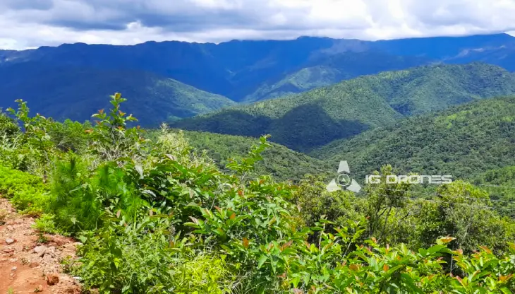
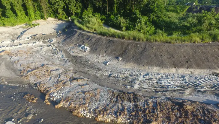
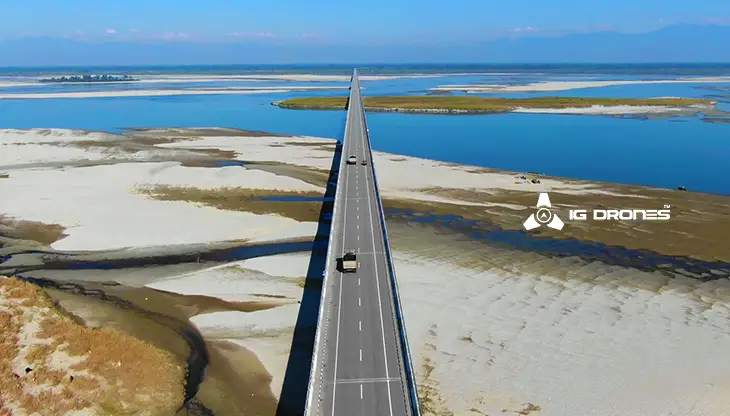
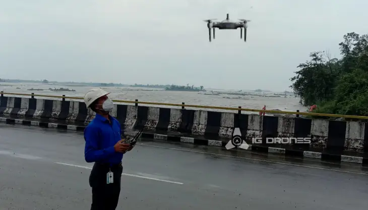
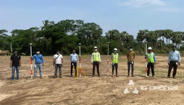
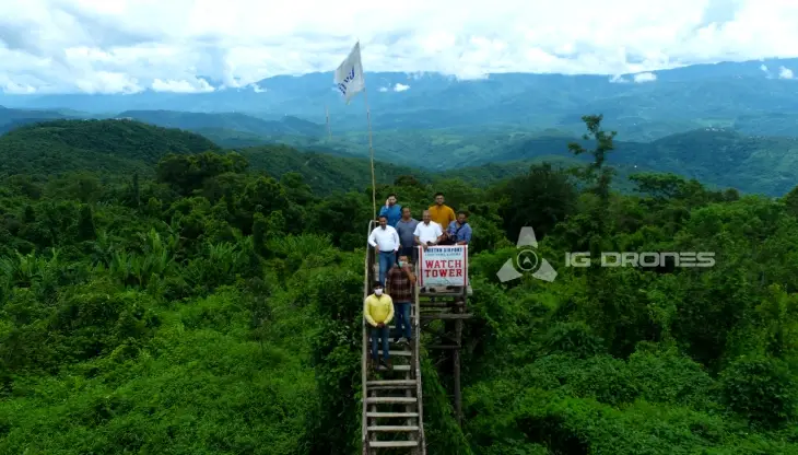
At IG DRONES, we are always working on something new! We are proud of our latest work.
Some of our notable drone services across the industries include
IG DRONES is a well - established drone company that provides a bespoke, flexible and an end- to-end solution, using cutting-edge drone technology. We cover a great mass of fields such as aerial surveying, mapping, and inspection services in order to help the government and corporate sectors of the country to prevent assets up to their full potential. Drone-based power line monitoring, industrial inspection, bridge inspection, solar plant inspection, pipeline inspection, railway services (survey, mapping, and inspection), smart city survey, road survey, mine survey, agricultural survey, forest and wildlife survey, disaster assessment, wind turbine blades inspection, port survey, buildings & skyscrapers inspection, and monuments inspection are a few among the numerous services that we provide.
IG Drones aims at providing airborne drone surveying, mapping, and inspection services to clients globally. IG Drones has been of great service in various fields such as land surveying, aerial surveys, land management and development, land slope monitoring, stockpile volumetric measurements, smart city design, green field project mapping, and other areas of expertise. IG Drones has marked its rule over various fields and it often produces centimeter-level topographic maps. Drone Data Processing is the most recent geospatial technology innovation, and drones are used in numerous businesses. Special gratitude to our high-end surveying drones and a team of skilled licensed pilots who ensured that our clients get their deliveries sooner than expected. We continue to use Artificial Intelligence and Machine Learning to climb up to 99 percent accuracy in volumetric measurements, crop yield estimates, damage detection, and other areas and hence, people are bound to make quick decisions.


Talk to our team if you have any questions about drone surveying for your industry.
Contact Us for Drone Services in Karnataka Contact UsIG Drones provide specialist drone services at height and difficult to access areas across India. Technical end-to-end solution to help you ease your operation. Capture the smallest of details with ease. Raise your operational standards & Imagine more with us. Imagine Inspire Innovate.
