
Bangalore/ Bengaluru, also spelled Bangalore, formerly Bangalore, city, capital (since 1830) of Karnataka state, southern India. Bengaluru is one of India’s largest cities. It lies 3,113 feet (949 meters) above sea level, atop an east-west ridge in the karnataka Plateau in the southeastern part of the state, at a cultural meeting point of the Kannada,Telugu and Tamil-speaking people. Bangalore consists of the closely built old town, together with a number of modern outlying areas (former suburbs) laid out in a gridiron pattern to the north and south, with many parks and wide streets. A large military area is situated just southeast of central Bengaluru. Outlying areas incorporated into the city in 2007 include large green spaces as well as farmland and are sites of population and ICT-related growth.
On being rewarded as being India's Most Promising Drone Consultants, IG Drones is now a leading drone service provider of India. IG Drones was established in 2018 and it aimed at providing enterprise drone solutions across India and revolutionizing traditional industrial procedures with high quality efficient drones. IG Drones is one of Bangalore’s top drone service providers. In various other South Indian states as well, IG Drones deliver drone survey solutions, drone mapping, and inspection services. IG Drones have been awarded as “Airwards's Best Drone Organisation-Startup”. It is because of our consistency in Pre and Post Disaster Assessments and constant efforts in Search and Rescue Operations that we as a team have successfully reached up to this stage. In line with government missions, it is responsible for the training and enhancing of the abilities of India's youth to prepare them for the oncoming Industrial 4.0 Revolution. The IG Drones Drone Center of Excellence (CoE) is a program that was established with an aim of educating more than 10 million students about the newest drone technologies.


IG drones provides enumerable services such as GIS Survey, Topographic Survey, Drone Inspection, Drone Mapping, Power line Monitoring, Smart City Survey, Road Inspection & Survey, Mines Survey, Flood Assessment, Asset Monitoring, Solar Thermal Inspection, Security and Surveillance, Crop Health Monitoring, Volumetric Measurement, and Drone 3D Mapping & Modelling. Since 2018, IG Drones has been generating high-quality drone surveys and mapping services in Bangalore (Karnataka) and other Southern regions in Visakhapatnam (Karnataka) Mysore(Karnataka) RAICHUR-KURNOOL (Karnataka) NAIDUPETA, (Karnataka) Roing (Arunachal Pradesh) Bangalore(Karnataka) Mysore (Karnataka) (Ooty) Karnataka (Auroville) Karnataka
Get in touch with IG DRONES to experience the India's best Drone Service Company first-hand
Contact Us!We have clients across Bangalore Karnataka & other Southern Regions on like – G R Infraprojects Limited , Karnataka Forest Department , Geocon Surveys , Kudgi Narendra Transmission Line Sekura Roads, KEC International , ITC Limited, CK Rajan Engineering Contractor , CPWD , Karnataka Forest Department


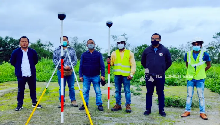
At IG DRONES, we are always working on something new! We are proud of our latest work.
Some of our notable drone services across the industries include
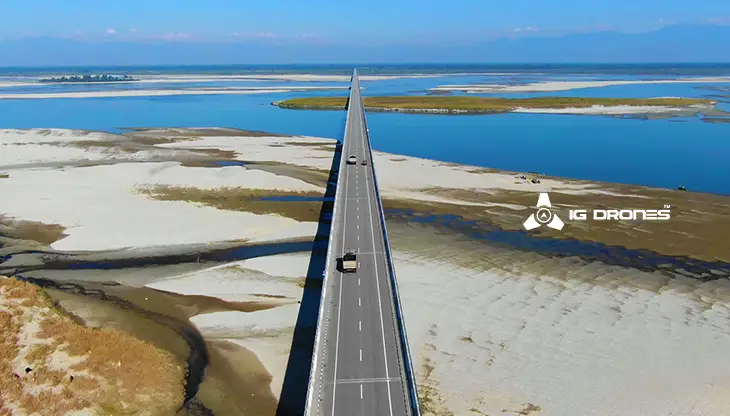
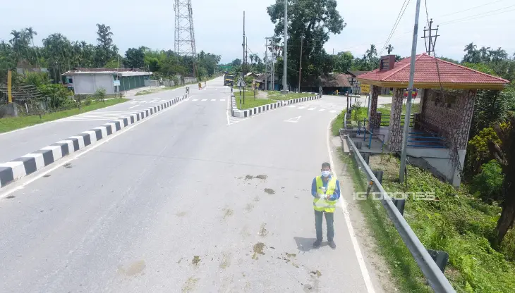
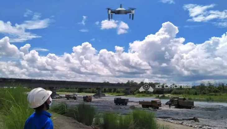
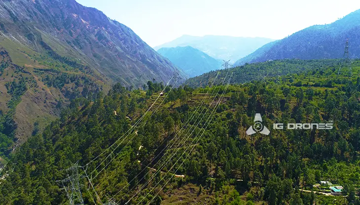
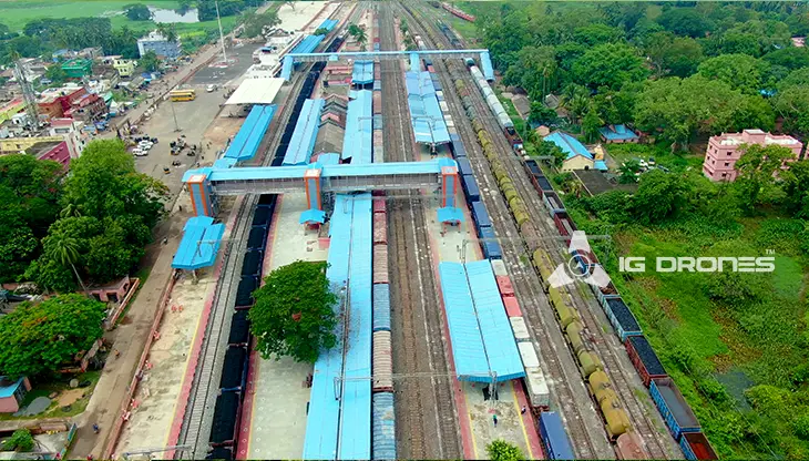
IG DRONESis a famous drone company that provides a bespoke, flexible and an end-to-end solution, using cutting-edge drone technology. We cover a great mass of fields such as aerial surveying, mapping, and inspection services in order to help the government and corporate sectors of the country to prevent assets up to their full potential. Drone-based power line monitoring, industrial inspection, bridge inspection, solar plant inspection, pipeline inspection, railway services (survey, mapping, and inspection), smart city survey, road survey, mine survey, agricultural survey, forest and wildlife survey, disaster assessment, wind turbine blades inspection, port survey, buildings & skyscrapers inspection, and monuments inspection are a few services that we provide.
IG Drones objective is to provide airborne drone surveying, mapping, and inspection services to clients globally. IG Drones has been successful in providing a wide variety of services in land surveying, aerial surveys for land management and development, land slope monitoring, stockpile volumetric measurements, smart city design, green field project mapping, and other areas of expertise. Since IG Drones have conquered all fields and established a great significance on precision, it often produces centimeter-level topographic maps. Drone Data Processing is the most recent geospatial technology innovation, and drones are used in numerous businesses. Special gratitude to our high-end surveying drones and a team of skilled licensed pilots since they ensured that our clients get their deliveries sooner than expected. We continue to use Artificial Intelligence and Machine Learning to climb up to 99 percent accuracy in volumetric measurements, crop yield estimates, damage detection, and other areas and hence, people are compelled to make decisions in a rapid way.


Talk to our team if you have any questions about drone surveying for your industry.
Contact Us for Drone Services in Karnataka Contact UsIG Drones provide specialist drone services at height and difficult to access areas across India. Technical end-to-end solution to help you ease your operation. Capture the smallest of details with ease. Raise your operational standards & Imagine more with us. Imagine Inspire Innovate.
