The use of technology has advanced in recent times. Nowadays, drones are being used a lot in disaster management and provide an accurate image in significantly less time than manual identification by inspectors. The drones capture high-resolution photos and thermal images to help identify the site and identify the issues.
IG Drones provide an excellent solution for the rapid assessment of the natural disaster-affected areas. By providing efficient and practical solutions for the research of cause of the disaster and for the rapid assessment of the damaged infrastructure and people trapped under debris, they are instrumental. Drones can provide high-resolution, real-time images of even inaccessible locations in a short span of time and hence finding it’s application in disaster management & rescue operations.
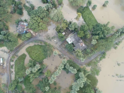
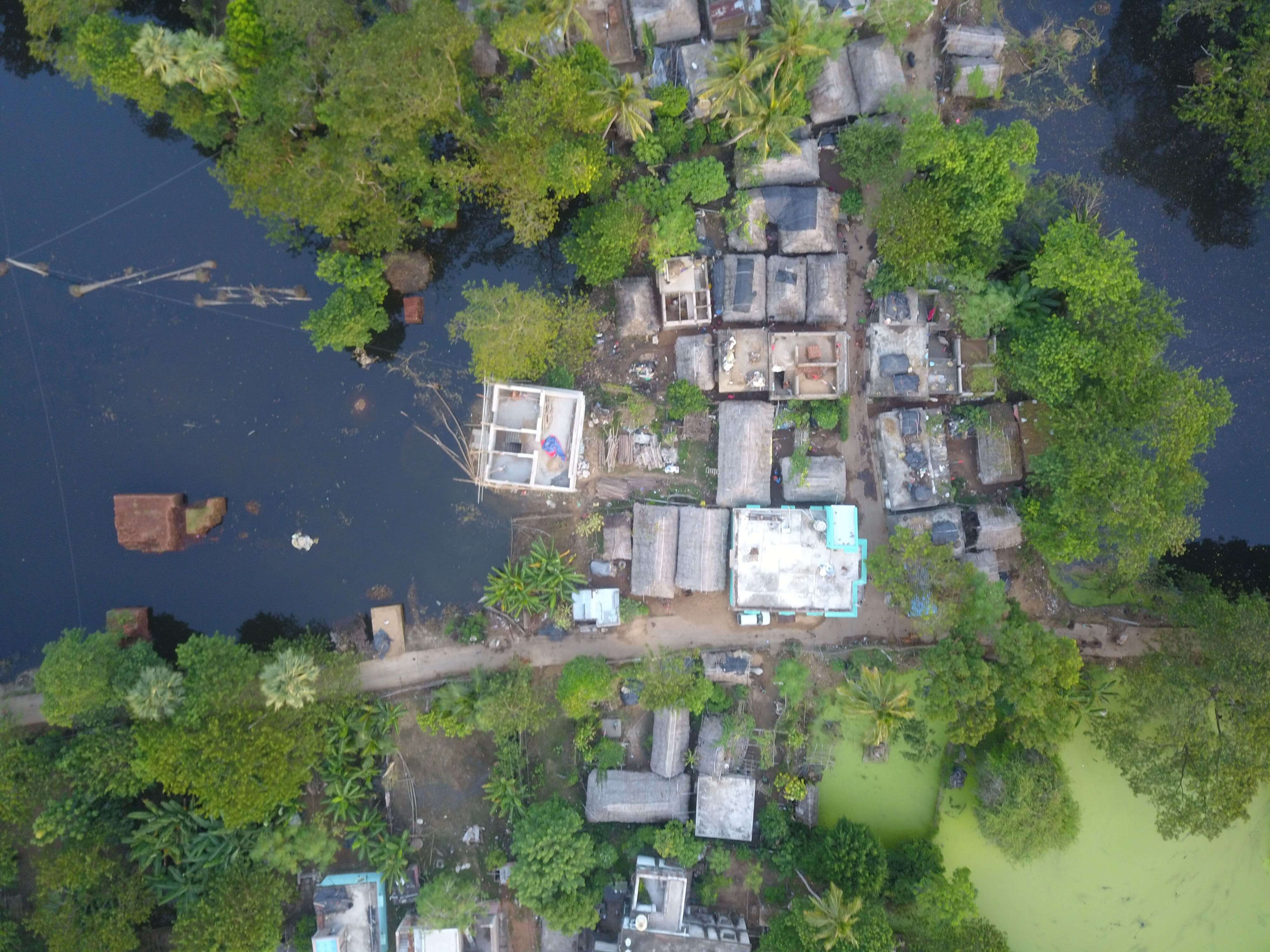
Our efforts as the IG Drones team have always been to make use of technology to aid people during crucial times. Our team assessed the entire situation in the flood-affected state of Odisha with the help of our sophisticated IG Drones. Our approach to the whole situation was simple and holistic. It covered the various aspects regarding finding the intensity of the flood, the affected areas, and people stuck in an area or needing help. Large chunks of affected areas were being mapped with the help of our sophisticated drones which proved effective in the quantification of losses by the help of the generated 3D models.
Despite the challenges faced by the team, our ground team was able to carry out the post-disaster analysis with a systematic approach and left no stones unturned in making the output out of the resources with every minute details. The mapped areas not only provided an estimated damage percentage but also clearly marked out the elements affected in the social outfit. The data captured were used in the preparation of hazard maps so that the prevention and mitigation measures for reducing disaster risks are planned accordingly. Our effort in providing a rapid assessment of the situation has helped to provide support to people in flooded areas. Here are some of the images from the video captured by the drones while assessing the area:
IG Drones provide specialist drone services at height and difficult to access areas across India. Technical end-to-end solution to help you ease your operation. Capture the smallest of details with ease. Raise your operational standards & Imagine more with us. Imagine Inspire Innovate.
Copyright © 2024. All Rights Reserved By IG Drones.
